Updated November 17, 2022
If you love the outdoors, San Francisco is one of the best cities in the United States. Surrounded by rolling hills and mountains, the Bay Area is a picturesque urban area that’s home to its fair share of hiking trails and scenic parks. There is no shortage of great hikes around San Francisco, with options for all levels of experience. We wrote this massive guide to share 27 of the most stunning Bay Area hikes!
Best Bay Area Hikes
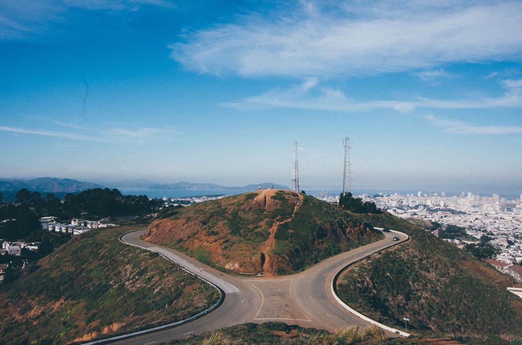
Twin Peaks
- Distance: 2.1 miles
- Difficulty: Easy
- How to Get There: Take the 37 Corbett mini bus to the base of the mountain
As one of the most iconic viewpoints in San Francisco, Twin Peaks is an excellent hike for all levels. Twin Peaks is one of the most popular Bay Area hikes, and for good reason. The summit boasts panoramic views of the city and the surrounding Bay Area. On clear days, you can catch spectacular views of the Golden Gate Bridge, Alcatraz, and downtown San Francisco. Located in the Twin Peaks Nature Area, the trail and its surroundings are also home to several species of native wildlife and plants. Depending on the season, you may even be able to spot wildflowers.
Pro tip: To avoid crowds and get the best photo lighting, hike to Twin Peaks around sunrise.
Mount Davidson Park
- Distance: 1.5 miles
- Difficulty: Easy
- How to Get There: Take bus 36 or 57 to the stop at Dalewood and Landsdale, then follow the wooded trail (unsigned)
Another urban hike that’s highly recommended by locals is the loop trail at Mount Davidson Park. Located on the highest point in San Francisco, this trail brings you through parts of the city’s natural rainforest areas. It winds through eucalyptus trees and provides jaw-dropping views of the city and the bay below. The trail also has plenty of wildflowers and serene areas to walk in tranquility and nature.
Pro tip: There are no signs on the trails here, so stick to obvious trail areas and go slow.

Golden Gate Bridge & Park
- Distance: Varies; crossing the bridge is 3.4 miles
- Difficulty: Easy to moderate
- How to Get There: You can take several public transportation routes to get to the Golden Gate Bridge – click here to learn more
Let’s face it: the Golden Gate Bridge is one of the USA’s most iconic and well-known landmarks. However, did you know that there’s a pedestrian trail across the bridge, as well as a network of trails in the surrounding park area? The total length of the bridge is 1.7 miles one-way, so you’ll get a decent stroll just by crossing. However, if you’d prefer a longer pathway, hit up some of the gravel trails in Golden Gate Park’s 1,700+ acres of bayside recreational space. Some of the paths will take you to abandoned structures or over some of San Francisco’s famous hilly terrain. This is perfect for a bit more of a challenge or for trail running.
Glen Canyon Park
- Distance: 1.9 miles
- Difficulty: Easy
- How to Get There: Bus line 44 goes directly to Glen Canyon Park; it is also accessible from several BART stations
Located in the center of San Francisco, Glen Canyon Park is home to an almost 2-mile loop trail that’s accessible for all levels of hikers. Not only does the trail provide gorgeous, elevated views of San Francisco, but it’s also dog- and family-friendly. You’ll hike through rocky hills, dense wooded areas, and meadows that will make you feel like you’re surrounded by nature. The trail also boasts spectacular panoramic vistas of the city.
Pro tip: This hike is best during the springtime, when wildflowers begin to bloom in the areas surrounding the trail.
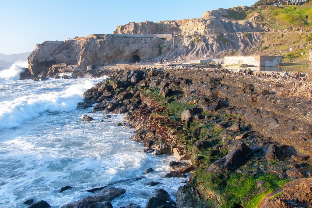
Lands End Trail
- Distance: 3.5 miles
- Difficulty: Moderate
- How to Get There: Bus line 38 runs from downtown San Francisco to the trail head for Lands End
Located in a small, seemingly untouched corner of the city, Lands End Trail is one of the wildest and most beautiful Bay Area hikes. With its variety of abandoned structures (including shipwrecks and the Sutro Baths) and its rocky shorelines, this trail brings you from SF’s fast-paced streets to a serene, rugged nature environment. The views of the bay from the trail and the shoreline are absolutely breathtaking. While the Lands End trail itself isn’t too difficult, you’ll want to make sure that you wear sturdy shoes. Also, be prepared for stairs – the terrain is quite hilly and rocky here.
Pro tip: Go early for the best views! The trail can get very crowded during peak hours and on weekends.
Angel Island
- Distance: 4.8 miles
- Difficulty: Easy
- How to Get There: Take the Tiburon Ferry, Blue & Gold Ferry, or the East Bay Ferry to Angel Island (note that there is an additional fee to enter the park)
Formerly the customs point for entrants to the United States, Angel Island is now a beautiful island-park in the middle of San Francisco Bay. On clear days, you can see gorgeous views of San Francisco, the Golden Gate Bridge, and the Marin Headlands. Once you’re there, you can hike the island’s perimeter road (~5 miles) or summit the park’s Mount Livermore for some breathtaking, 360-degree views. It is truly one of our favorite Bay Area hikes!
Pro tip: This park gets VERY crowded as it is a major tourist attraction in San Francisco. We’d recommend visiting on weekdays or early in the morning for the smallest crowds.
Note: As of June 2021, the Immigration Station guided tours and some restrooms are closed. Check here for the most up to date info about park closures.
Beautiful Bay Area Hikes
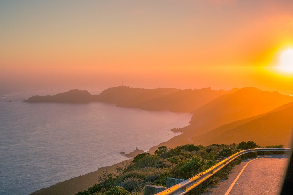
South Headlands Loop
- Distance: 7.8 miles
- Difficulty: Moderate
- How to Get There: You can drive and park nearby or take an uber.
One of the locals’ favorite hikes in San Francisco is the South Headlands Loop. This trail is located in Marin Headlands, a scenic park across the Golden Gate Bridge from San Francisco. The South Headlands Loop is a bit more strenuous, given its nearly 8-mile trail length and variety of rocky coastline terrain. From the trail, you’ll catch views of the Golden Gate Bridge, downtown San Francisco, and the shoreline.
Tennessee Valley
- Distance: 3.4 miles
- Difficulty: Easy
- How to Get There: The 76X bus runs on weekends from downtown San Francisco to Marin Headlands. Otherwise, you can drive and park nearby. *Note: As of July 2020, the 76X bus is suspended until futher notice. Check here for updates.
As one of the most scenic trails in the Marin Headlands, the Tennessee Valley trail is an easy and incredibly beautiful pathway to tackle, especially if you’re on a time crunch. This easy trail features seaside trails and stunning views of the rocky Marin Headlands bluffs. You’ll start in the meadows of the headlands and walk all the way to the coast, which provides a variety of views and photo opportunities that span from grassy meadows to craggy shorelines. For one of the easiest and most picturesque Bay Area hikes, look no farther than Tennessee Valley.
Note: As of July 2021, this trail is subject to seasonal closure due to weather conditions. Check here for updated information on trail closures in this area.
Tomales Point
- Distance: 9.4 miles
- Difficulty: Moderate
- How to Get There: The easiest way to get to Tomales Bay Park is by car
Located in the Point Reyes National Seashore area, Tomales Point is one of the most stunning places to go hiking near San Francisco and the Bay Area, in our opinion. This moderate hike has jaw-dropping views of the coastline at Point Reyes National Seashore, and it’s challenging enough to give you a decent workout, too. In addition to amazing views, Tomales Point and the surrounding areas are full of local wildlife, including elk, and colorful spring wildflowers.
Pro tip: Parts of the trail can get overgrown in the warmer times of the year, so be sure to wear full-length pants and long sleeves for added protection.
Note: As of March 2021, sections of the Point Reyes park are closed due to wildfire. Check here for updated information on trail closures in this area.
Nimitz Way Trail at Inspiration Point
- Distance: 5.9 miles
- Difficulty: Moderate
- How to Get There: Take the BART to Berkeley, then call an Uber to the trail head; alternatively, there is parking on-site if you’d prefer to drive
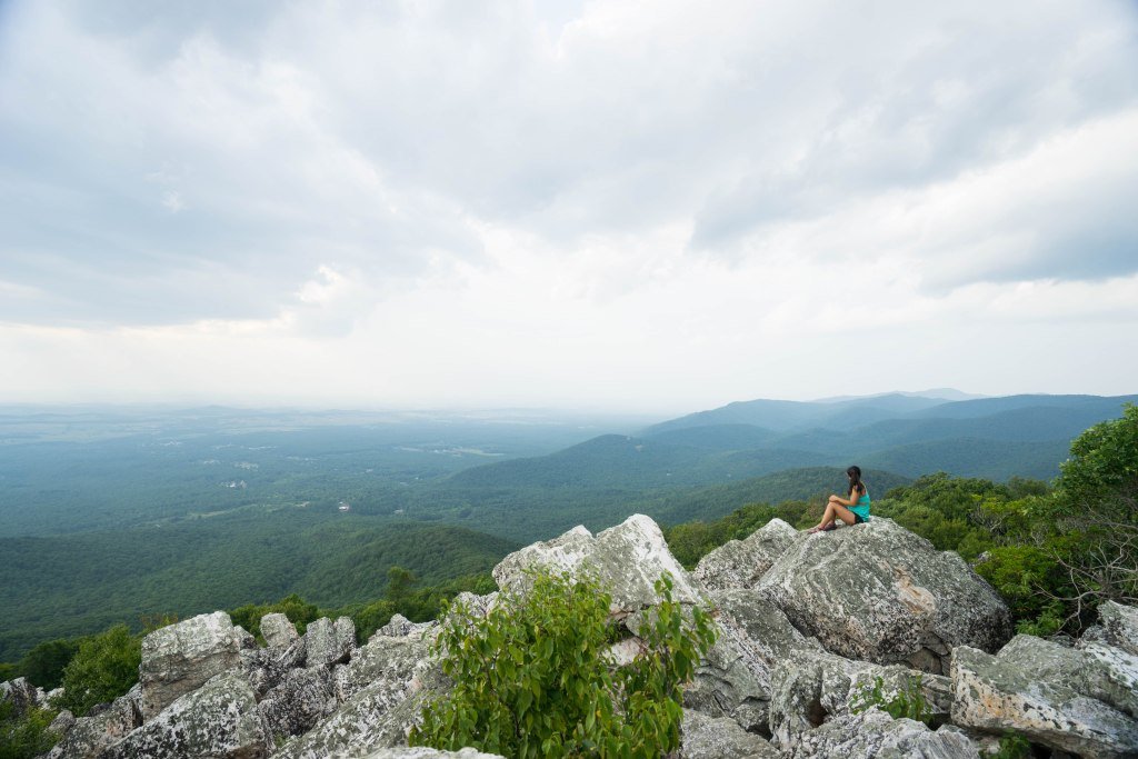
Nimitz Way Trail may be one of the most visually interesting Bay Area hikes. On one side, you get gorgeous city views from a bird’s eye perspective. On the other side, you’ll see green mountains and sparkling lakes that look completely remote and untouched. We included the Nimitz Way Trail to Inspiration Point because it’s a bit more challenging than some of the other urban hikes on our list, but also because it’s got some of the best natural views in the Berkeley area.
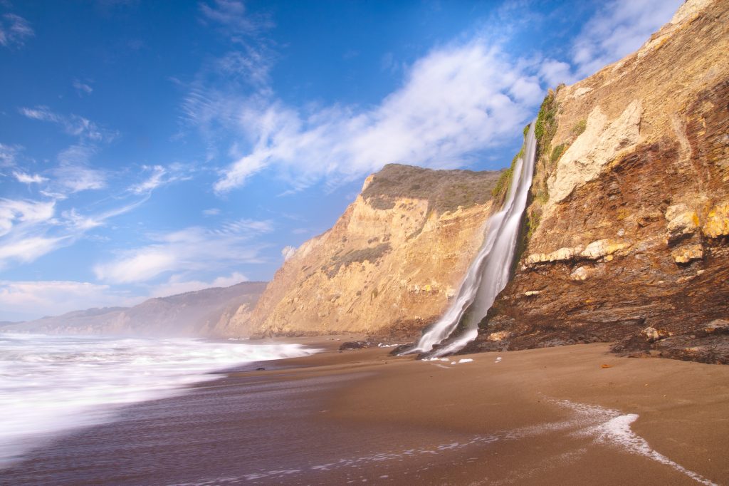
Alamere Falls Trail
- Distance: 13.8 miles
- Difficulty: Moderate
- How to Get There: The easiest way to get to Point Reyes National Seashore from San Francisco is by car
As one of Northern California’s most beloved hikes, Alamere Falls Trail is a lengthy but worthwhile seaside hike that ends at a stunning viewpoint of Alamere Falls crashing into the ocean from the top of a rocky bluff. The trail is well-marked and passes along the Pacific coastline, winding through several viewpoints of the surrounding hills and lakes. There’s an optional access point to the beach towards the end of the trail, but it can be quite slippery and steep – proceed at your own risk and with caution!
Cataract Falls
- Distance: 3.3 miles
- Difficulty: Moderate
- How to Get There: The easiest way to get to the Mount Tamalpais area is by car
As one of the most popular spots for hiking near San Francisco, Cataract Falls is a cross between a woodland fairytale and rushing mountain waterways. Located in the Mount Tamalpais area, this trail is the perfect spot for a family outing or a solo hike through some beautiful, shaded areas of northern California. Wooded boardwalks and gravel trails take you through the forest to several different waterfalls, which are a welcome change from some of the sunnier, drier peak hikes you’ll find in the Bay Area.
Pro tip: Cataract Falls is one of the more popular Bay Area hikes, so try to visit on a weekday if you’re hoping to avoid the crowds.
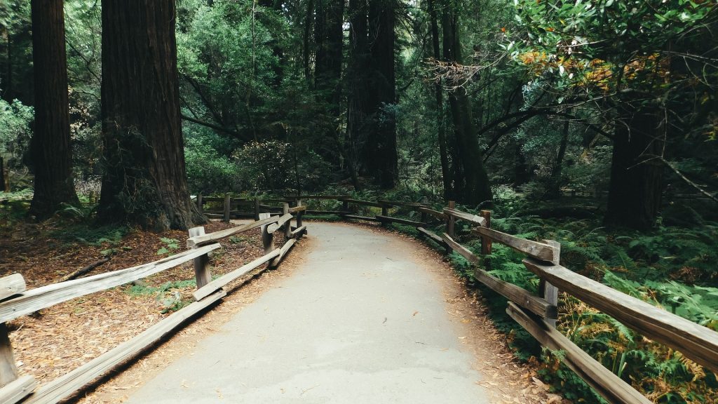
Muir Woods Trail
- Distance: 2.2 miles
- Difficulty: Easy
- How to Get There: You can drive or take a bus from downtown SF to Muir Woods National Monument
The Muir Woods Trail is one of the most popular trails in the Muir Woods National Monument area, as it provides a lovely glimpse into the massive Redwood forests in this part of Northern California. Family-friendly and fairly flat, Muir Woods Trail is a great spot to visit on a California road trip or if you’re traveling in a group with mixed levels of experience.
Here, you’ll find densely wooded trails and well-groomed trails that are great for hikers of all levels. Note that you need a National Parks Pass to get into the trail area, or you can pay a day visit fee to enter.
*Note: Muir Woods charges a fee per person to enter. Check here for rates.
Dipsea Trail (Muir Woods)
- Distance: 9.7 miles
- Difficulty: Challenging
- How to Get There: You can drive or take a bus from downtown SF to Muir Woods National Monument
For hikers looking for an extra challenge, Dipsea Trail is one of the most highly recommended and beloved spots for hiking near San Francisco. Located in the Muir Woods National Monument area, the trail extends from the dense, foggy Redwood forests all the way to the shore at Stinson Beach. With steep inclines and descents, the Dipsea Trail provides a challenge even for experienced hikers, but the views and scenery make this long day hike worth the effort.
*Note: Muir Woods charges a fee per person to enter. Check here for rates.
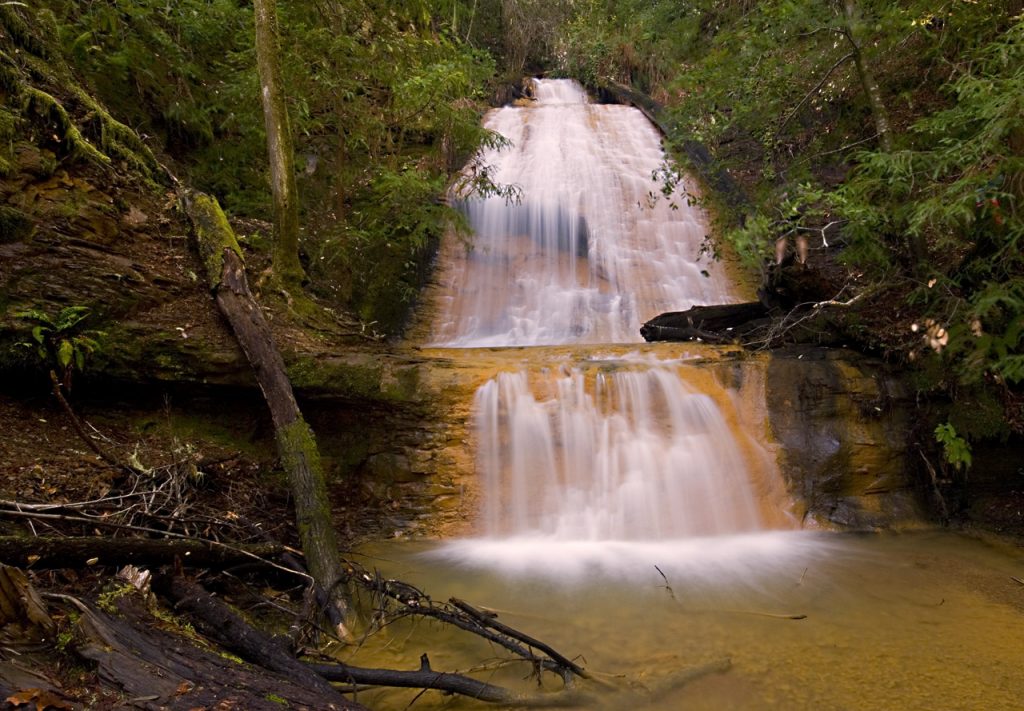
Berry Creek Loop at Big Basin Redwoods State Park
- Distance: 11.2 miles
- Difficulty: Moderate
- How to Get There: The easiest way to get to Big Basin is by car
If you’re looking for cool and shady Bay Area hikes, look no further than the Berry Creek Loop in Big Basin State Park. This 11.2 mile trail winds through the Redwood forest and brings hikers to a lovely waterfall. The Berry Creek waterfall is stunning and the hike to get there provides a challenge that’s accessible to even less-experienced hikers (with some patience and grit!). Along the way, you’ll find wooded trails, scenic bridges, and some views of the city and the surrounding nature areas.
Note: As of March 2021, this trail is currently closed due to wildfire. Check here for updates on park closures.
Castle Rock Trail
- Distance: 5.9 miles
- Difficulty: Moderate
- How to Get There: The easiest way to get to Mount Diablo from San Francisco and the Bay Area is by car
Castle Rock Trail is a scenic loop trail in the western part of Mount Diablo State Park, and is one of the more popular places to go hiking near San Francisco and the Bay Area. Featuring gorgeous wildflower displays, rock formations, and sweeping views of the surrounding Mount Diablo park areas, the trail is marked by a couple of steep inclines but overall is pretty easy. Throughout the trail, you’ll also get to see the warped remains of old oak trees and pastures of grazing cattle, too.
Pro tip: From the Castle Rock loop, you can summit Mount Diablo if you’re feeling extra ambitious!
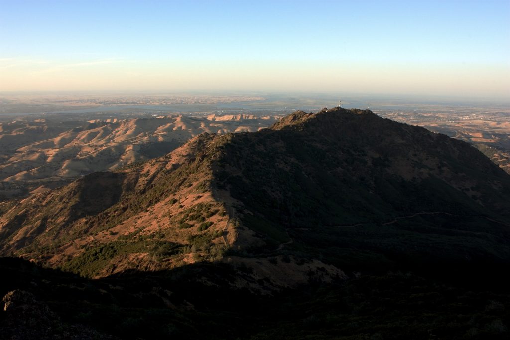
Mount Diablo Grand Loop
- Distance: 6.8 miles
- Difficulty: Moderate
- How to Get There: The easiest way to get to Mount Diablo from San Francisco and the Bay Area is by car
The Mount Diablo State Park is one of California’s most beloved outdoor areas, and the Mount Diablo Grand Loop is the perfect way to get a taste for it. If you’re looking for an area to go hiking near San Francisco, Mount Diablo State Park has almost certainly got something for you. Green rolling hills and big skies offer stunning views of the surrounding mountains and valleys, especially on sunny days. You’ll pass through rugged desert-type landscapes and lush greenery (and see some pretty spectacular views) throughout the 6.8 miles that this grand tour of Mount Diablo has to offer!
Donner Creek Loop
- Distance: 5.1 miles
- Difficulty: Moderate
- How to Get There: The easiest way to get to Mount Diablo from San Francisco and the Bay Area is by car
If you love waterfalls, you’re in for a real treat on the Donner Creek Loop. This is one of the most scenic Bay Area hikes, as it winds through forested areas and has four different waterfalls for you to explore. You’ll also catch some beautiful views of the valleys below and the surrounding peaks. During the hike, you’ll have to cross some streams, so it’s wise to wear waterproof hiking boots if you’re planning to tackle it, especially after a period of rain.
Pro tip: Do this hike after it rains to get the best waterfall views.
Eagle Peak Loop
- Distance: 7.6 miles
- Difficulty: Moderate/difficult
- How to Get There: The easiest way to get to Mount Diablo from San Francisco and the Bay Area is by car
For a strenuous hike that’s a bit more off-the-beaten-path than many others on this list, Eagle Peak Loop is an incredibly picturesque and challenging trail in Mount Diablo State Park that has excellent views of Mitchell Canyon. On clear days, you can see all the way out to the Sierra Nevada mountains on trails lined with colorful, bright wildflowers. We’d recommend bringing trekking poles on this hike, as there are some steep sections with loose gravel.
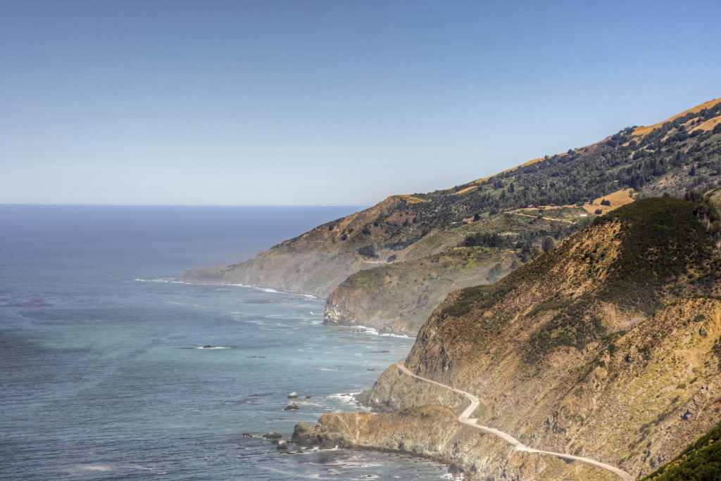
Vicente Flat Trail
- Distance: 10.9 miles
- Difficulty: Moderate
- How to Get There: The easiest way to get to Big Sur from San Francisco and the Bay Area is by car
Spanning forests, mountains, and grazing the coastline, Vicente Flat Trail is arguably one of the most spectacular hikes near San Francisco. With a pathway that moves in and out of shady areas, you’ll get a balance of sun and shade on this trail. During the first half of the hike, look around for spectacular views of the Big Sur coastline. Many people opt to split this hike across two days and camp at Vicente or Espinosa campsites. It’s a lovely overnight hiking trip with gorgeous sunset views!
Pro tip: There’s poison oak and lots of bugs on the trail here, so be sure to use bug repellent and wear long socks to avoid any itchy scenarios.
Palos Colorados Trail
- Distance: 3 miles
- Difficulty: Easy
- How to Get There: The easiest way to get to Palos Colorados is to drive. You can also take an Uber/Lyft, but note that this park does not have good phone service, so pre-arranging transportation is recommended
If tall trees, babbling creeks, and dirt pathways are your calling, the Palos Colorados Trail in Oakland’s Joaquin Miller Park is one of the best Bay Area hikes for you! This easy, relatively short out-and-back trail is perfect for families and beginners, as it’s easy to get to from San Francisco and has beautiful exposure to the towering Redwood trees in the area. The Palos Colorados Trail is also a fantastic place for hiking in rain or shine, as the fog through the trees can make for some seriously spooky effects.
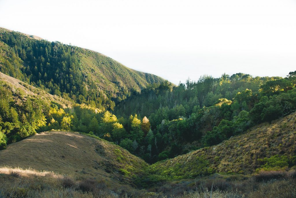
Ewoldsen Trail
*This trail is temporarily closed – check here for the latest updates
- Distance: 5 miles
- Difficulty: Difficult
- How to Get There: The easiest way to get to Big Sur from San Francisco and the Bay Area is by car
Passing through redwood forests and rocky shores, the Ewoldsen Trail is one of the most stunning Bay Area hikes. With its location in the Big Sur area, you’re in for a real treat here, with sweeping views out to the ocean in between densely forested pathways. Be sure to use bug repellent here (there are allegedly a LOT of ticks) and wear long pants, as the trail in some areas has a lot of vegetation.
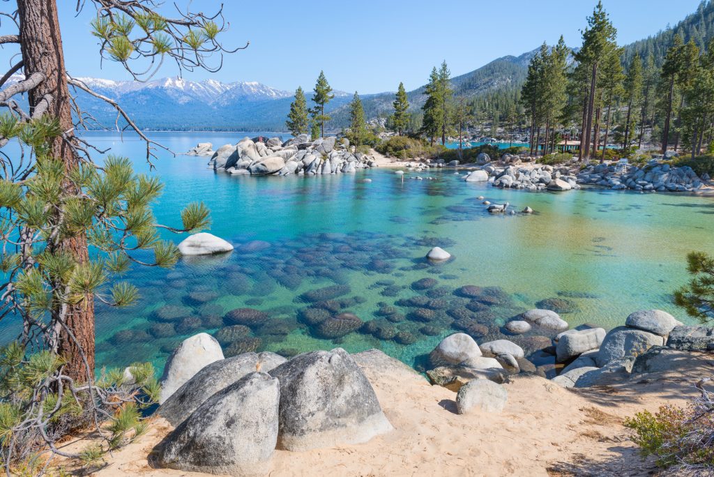
Rubicon Trail
- Distance: 16.4 miles
- Difficulty: Moderate
- How to Get There: The easiest way to get to Lake Tahoe from San Francisco is by car
If you’re looking to trade Redwoods for evergreens, head to the Rubicon Trail in the southern part of Lake Tahoe. Located in D. L. Bliss State Park, this long out-and-back trail has stunning views of the teal lake, surrounding mountains, and plenty of shaded spots for a quick siesta. You can walk the entire 16.4 miles or simply go as far as you want and then turn around – you’ll be able to catch absolutely stunning views basically the entire hike. Parts of the trail are closed during the winter, so plan accordingly or visit during the peak months between April and October.
Note: Seasonal road closures may affect roads leading to the trailhead. To check for road closures, click here.
Meeks Bay to Crag Lake
- Distance: 9.8 miles
- Difficulty: Moderate
- How to Get There: The easiest way to get to Lake Tahoe from San Francisco is by car
With its gorgeous wildflower-lined paths and sweeping Lake Tahoe vistas, the Meeks Bay to Crag Lake trail is perfect for hiking near San Francisco and the Bay Area. Running through Desolation Wilderness, this trail is particularly appealing for those wanting some tranquility and serenity during their walk. You’ll meander through rock formations, tall pine tree forests, and alpine meadows, ending at the scenic Crag Lake, which is the perfect spot to dip your toes or take a lunch break.
Quicksilver History Loop
- Distance: 8 miles
- Difficulty: Moderate
- How to Get There: The easiest way to get to the Quicksilver History Loop is by car
For history and nature lovers, one of the best Bay Area hikes is the Quicksilver History Loop. Once home to some of the world’s most active mercury mines, the area used to be full of thriving mining communities. Today, it’s filled with 8 miles of scenic views, historic landmarks, and accompanied informational placards.
This trail will not only give you some fresh air and moderately difficult terrain, but will also teach you a little bit about the history of Northern California. Along the trail, you can view old mine entrances, abandoned furnaces, and former houses that miners worked in and occupied.
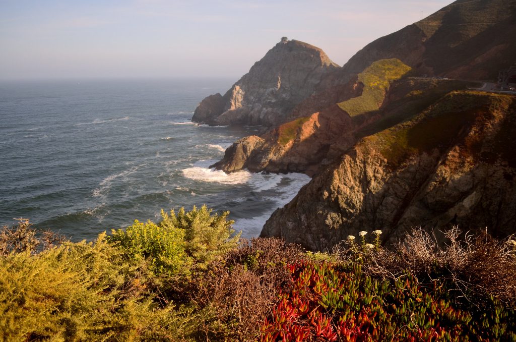
Devil’s Slide Trail
- Distance: 3.1 miles
- Difficulty: Easy
- How to Get There: Devil’s Slide Trail is most easily accessed by car
For breathtaking coastline views, there are few better or more accessible hikes near San Francisco than Devil’s Slide Trail. Filled with wildflowers, forested areas, and stunning sea views, this trail’s got everything in its short, 3.1-mile stretch. Devil’s Slide Trail is a short part of the 1,200-mile California Coastal Trail and attracts hikers from all over the country. Given its popularity with hikers, bikers, and trail runners, peak hours may be quite crowded here; however, you can avoid most of the crowds and the direct sunlight by starting early in the morning.
Fall Creek and Lost Empire Loop
- Distance: 8.4 miles
- Difficulty: Moderate
- How to Get There: The easiest way to get there is by car
Located in Henry Cowell Redwoods State Park, the Fall Creek and Lost Empire Loop is a scenic trail that winds through the majestic redwoods in the park. Since nearly the entire trail is heavily forested, the Fall Creek and Lost Empire Loop is a great option for hikers wanting to take a literal “walk in the woods.”
Note: As of June 2021, areas of Henry Cowell Redwoods State Park are closed due to wildfire. Check here for updates on park closures.
Additional Resources for Bay Area Hikes
What to Bring for Hiking Near San Francisco
- Breathable hiking clothes – For warmer hikes, you’ll want to wear a sweat-wicking shirt and breathable pants, like these Patagonia hiking shorts for men and women. For cold-weather hikes, we recommend dressing in layers, including merino wool baselayers for men and women, a down puffer jacket for men and women, and a Northface waterproof outer shell for men and women (a must for hiking in Seattle). And don’t forget a pair of the best women’s and men’s hiking socks!
- Trekking poles – You won’t need these for every single hike, but we suggest throwing them in your car just in case. We recommend the Black Diamond Trail Ergo cork trekking poles, which are lightweight, easy to transport, and durable.
- Water bottle – Having water available at all times is a huge must. To limit disposable plastic, we recommend bringing your own refillable water bottle. We’re obsessed with Hydro Flask water bottles because they keep water cold for hours.
- Sunscreen and bug spray – Sweatproof sunscreen and DEET bug spray can help you avoid sunburn and bug bites, two of hiking’s most annoying after-effects. Our favorite kind of sunscreen is Sun Bum, as it is free of harsh chemicals and safe for marine life, including coral reefs.
- A brimmed hat or cap – The sun can be brutal in open hikes, so always pack a brimmed hat or cap for day hikes in the sunshine.
- Emergency blanket and first aid kit – We’d strongly recommend bringing a first aid kit and a lightweight emergency blanket on every hike. Why? Because the unfathomable can happen, and it’s always best to play it safe.
- Durable day pack – A durable day pack is the perfect spot to stash all your hiking gear. While any backpack will do, we recommend the Osprey Tempest 20 or the Talon 22 day packs because they’re comfortable and breathable for long hikes. For more information, check out our best day packs for any terrain guide.
Related Articles
- 15 Beautiful Spots for Skiing & Snowboarding near San Francisco
- 35 Practical Gifts for Hikers that They’ll Actually Use
- 50+ Outdoor Quotes to Inspire Your Next Adventure


