Updated June 18, 2021
Birmingham, Alabama may not be an obvious choice for outdoor activities, as its steel industry and legacy as a Southern city overshadow its beautiful nature. However, there are plenty of stunning hidden gems for hiking near Birmingham, AL, many of which offer access to some of the most beautiful landscapes in the South. Visitors may be surprised to know that there are hills, waterfalls, and mountains within minutes of Birmingham’s downtown area that are super fun and exciting to explore. We created this guide to the best hikes near Birmingham, AL so you can plan your next outdoor adventure ASAP!

Easy Hiking Near Birmingham, AL
Vulcan Trail
- Distance from Birmingham: 0 miles
- Trail Length: 1.7 miles
- Elevation Gain: Minimal
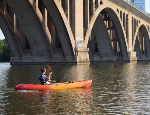
For some of the best views overlooking downtown Birmingham, the Vulcan Trail is a local favorite spot. With 1.7 miles of easy, flat trails that bring hikers to a stunning bird’s eye viewpoint, this is easily one of the most beloved hikes in Birmingham, AL. From the top, you can enjoy forested dirt paths that pass by a lot of local attractions, including the WBRC sign and the Vulcan statue, which is the largest cast iron statue in the world! The Vulcan trail is one of Birmingham’s quintessential trails and is suitable for all levels of hikers.

Overlook Trail at Ruffner Mountain
- Distance from Birmingham: 0 miles (Ruffner Mountain Nature Preserve)
- Trail Length: 2.8 miles
- Elevation Gain: 383 feet
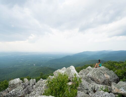
Did you know there are mountains within Birmingham’s city limits? Well, if you didn’t, you do now! The Overlook Trail is yet another example of hikes in Birmingham with spectacular views, and the trails here are accessible to all levels of hikers. Slightly challenging but absolutely do-able, the Ruffner Mountain Overlook Trail offers stunning views of the rocky cliffs and valleys below, and it’s just minutes from downtown Birmingham. If you’re looking for an easy hike that’s a little longer than the Vulcan Trail, the Ruffner Mountain Overlook Trail is a fantastic option.

Jemison Park Nature Trail
- Distance from Birmingham: 0 miles
- Trail Length: 3.4 miles
- Elevation Gain: 114 feet
Popular with trail runners and hikers alike, the Jemison Park Nature Trail offers a little bit of everything – nature, history, and wildlife. Passing alongside Shades Creek in a serene forest environment, it’s hard to believe that such a nature sanctuary exists in the middle of an urban area! Along the way, you can check out the historic Shades Creek Old Mill house, which is a popular spot for photographers during the less crowded times of day. Partially paved and partially dirt path, this is a great hybrid trail for those wanting to take a walk in the woods without leaving the city.

Narrows Ridge Trail
- Distance from Birmingham: 16 miles/25 minutes (Turkey Creek Nature Preserve)
- Trail Length: 2.4 miles
- Elevation Gain: 347 feet
For wildlife watching and walking in nature, the Narrows Ridge Trail is a fantastic place for hiking near Birmingham, AL. This scenic trail offers 2.4 miles of easy terrain that runs alongside Turkey Creek, offering hikers views of the creek’s still areas as well as a few small waterfalls. Hikers also report seeing wildlife like deer, foxes, and turtles in this area. There are some mile elevation and terrain changes throughout the trail, adding a bit of a fun challenge to this otherwise easy trail. Family-friendly and dog-friendly, there’s a reason why the Narrows Ridge Trail is one of the most beloved hikes near Birmingham, AL for locals and visitors alike.
Maggies Glen Loop
- Distance from Birmingham: 20 miles/30 minutes (Oak Mountain State Park)
- Trail Length: 2.2 miles
- Elevation Gain: 285 feet
Oak Mountain State Park is easily one of the most beloved and popular parks in the Birmingham area, and Maggies Glen Loop is one of the best easy hikes in the park. This 2.2-mile loop trail offers a peaceful nature environment that passes over small creek areas, rock formations, and wooden forest bridges. There are few easy trails in Birmingham that offer the solitude and quiet that Oak Mountain State Park does, and Maggies Glen Loop is a fabulous spot to experience it.

Bald Rock Boardwalk
- Distance from Birmingham: 81 miles/1.5 hours
- Trail Length: 0.6 miles
- Elevation Gain: Minimal
Short but epic, the Bald Rock Boardwalk sits on the top of Bald Rock Mountain and offers some of the best views of the Alabama countryside from its incredible vantage point. Because the boardwalk is made of wooden planks, it’s accessible to wheelchairs and strollers as well as beginners and young children. Along the way, you’ll find a few signs that offer up some information about the area and the construction of the boardwalk, but the views truly take the cake here. Come early in the day or later in the afternoon for the best views with the sun low in the sky.

Cutchenmine Trail
- Distance from Birmingham: 84 miles/1.5 hours (Lake Guntersville State Park)
- Trail Length: 4.4 miles
- Elevation Gain: 272 feet
Located in Lake Guntersville State Park, the Cutchenmine Trail is an excellent easy/moderate trail that’s perfect for immersing yourself in nature. The wide, slightly hilly paths of this trail pass by the lakeside, along creeks and rocky areas, and through many stretches of forested areas. While there aren’t any bird’s eye lookout points, the beauty here is in the tranquility of the lake and the solitude of nature, which you’ll absolutely get if you make the 1.5-hour drive to Lake Guntersville State Park.

Moderate & Difficult Hikes Near Birmingham, AL
Grace’s Gap
- Distance from Birmingham: 0 miles (Red Mountain Park)
- Trail Length: 3.9 miles
- Elevation Gain: 380 feet
For a bit more challenge than the Vulcan Trail, head to Grace’s Gap Overlook at Red Mountain Park for some really gorgeous Birmingham skyline views. Perfect for kids or hikers who want a bit of elevation gain, the Grace’s Gap Overlook is one of the city’s quintessential hikes that you absolutely should not miss.
This historic pathway passes by several old mining buildings, which offer hikers a glimpse into the history of the area. You can even enter some of them…if you dare. At the top, you’ll get to see wonderful views down into the central part of Birmingham. There’s also a wooden treehouse area you can climb into via wooden bridges to get an even better view.
Black Creek Trail
- Distance from Birmingham: 0 miles
- Trail Length: 2.4 miles
- Elevation Gain: 121 feet
To experience one of the most powerful and breathtaking waterfalls in the Birmingham area, head to the Black Creek trail. This short, 2.4-mile hike takes hikers along the Black Creek to a large cave area that’s located behind a mighty waterfall. To get there, you’ll have to cross wooden boardwalks and suspension bridges through the forest, a big part of the adventure and thrill of this trail! The scenery along the creek is also quite beautiful, with rocky shorelines surrounding the meandering waters.

Peavine Falls
- Distance from Birmingham: 20 miles/30 minutes (Oak Mountain State Park)
- Trail Length: 1.6 miles
- Elevation Gain: 377 feet
Who knew Alabama had so many stunning waterfalls? Another one of the most spectacular waterfall hikes near Birmingham, AL is Peavine Falls, which is located in Oak Mountain State Park. You’ll notice a trend here – Oak Mountain is home to some of the most beautiful and naturally stunning hiking near Birmingham. Peavine Falls is a short, 1.6-mile trail that brings hikers to its namesake cascade (pictured above). There’s some tricky terrain like root-filled trails and stone stairs as you make your way to the falls, but this trail is a fun challenge for anyone willing to try it!
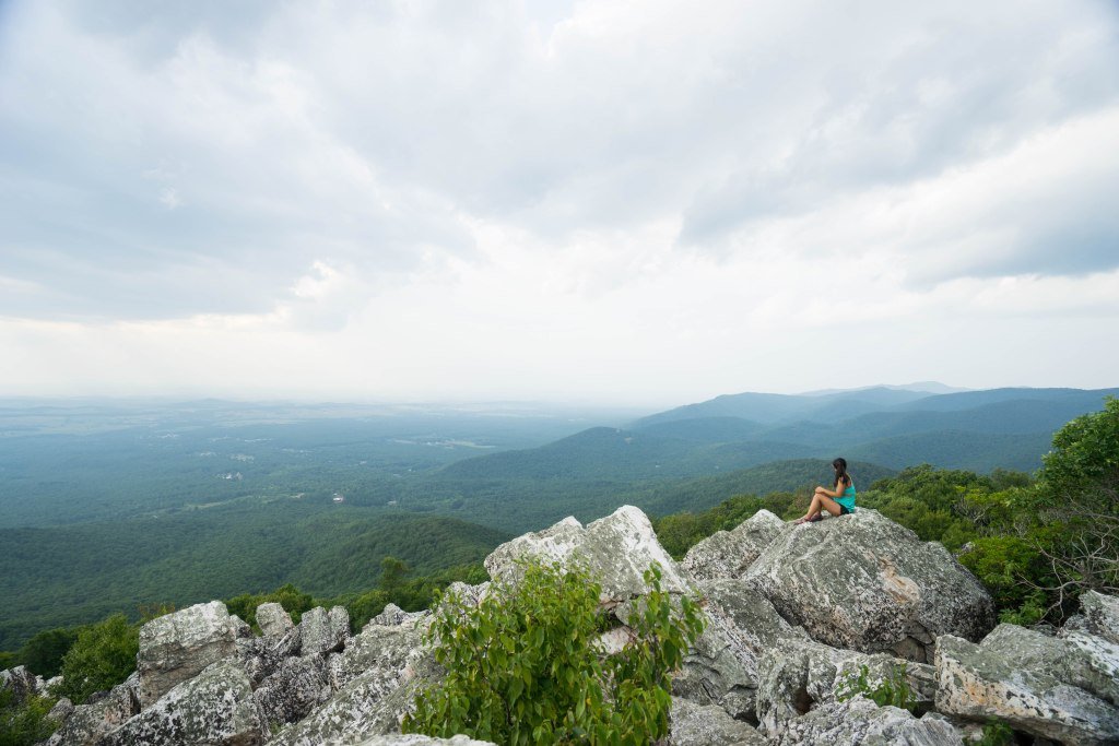
Kings Chair Overlook
- Distance from Birmingham: 20 miles/30 minutes (Oak Mountain State Park)
- Trail Length: 4.2 miles
- Elevation Gain: 734 feet
For mountain views that extend for miles, Kings Chair Overlook at Oak Mountain State Park is one of the best moderate hikes near Birmingham, AL. This trail spans 4.2 miles and 734 feet of elevation gain, offering exceptional views of the mountains from its rocky outcroppings along the way. With some steep areas and some rocky stretches, this trail is a bit of a challenge for hikers, but it’s doable for most experience levels as long as you’re up for the challenge. Go early in the morning on clear days in the fall for the best views with the most colorful variety!

Oak Mountain Blue Trail
- Distance from Birmingham: 20 miles/30 minutes (Oak Mountain State Park)
- Trail Length: 14.1 miles
- Elevation Gain: 2,139 feet
There aren’t many long, challenging trails near Birmingham, but the Oak Mountain Blue Trail is an exception. Clocking in at over 14 miles, this trail passes by Peavine Falls, Kings Chair, and several other great viewpoints and landscapes scattered throughout Oak Mountain State Park. Not for the faint of heart, this trail climbs 2,139 feet and has some seriously steep elevation gain at times. However, for experienced hikers looking for a day-long hike in stunning wilderness, there are few places better than Oak Mountain State Park’s Blue Trail.

Monte Sano Stone Cuts
- Distance from Birmingham: 106 miles/1 hour, 40 minutes (Monte Sano State Park)
- Trail Length: 2.4 miles
- Elevation Gain: 479 feet
One of the most unique hikes near Birmingham, AL is the Stone Cuts trail at Monte Sano State Park. Unlike the sweeping mountain views or raging waterfalls of many of the other trails on our list, the Monte Sano Stone Cuts offer something different – strange, otherworldly rock formations that erupt through the forest like works of art. You can hike through extremely narrow gaps between the rock formations and climb or scramble in some sections, making for a fun trail with lots of variety and challenge. Plus, it’s a great spot for photos!

Chewacla State Park Trail
- Distance from Birmingham: 144 miles/2 hours, 15 minutes
- Trail Length: 2.5 miles
- Elevation Gain: 232 feet
The waterfalls on the Chewacla State Park Trail are neither the tallest nor the widest, but they’re notable for one reason: the surrounding scenery. Perched in a river filled with large boulders and rock formation, there’s nothing quite like it. It’s a bit far from Birmingham, but if you’re looking for a wonderful day trip from Birmingham to a scenic hiking trail, Chewacla State Park is a fantastic choice!
Additional Resources for Hiking Near Birmingham, AL
What to Pack
- Breathable hiking clothes – For warmer hikes, you’ll want to wear a sweat-wicking shirt and breathable pants, like these Patagonia hiking shorts for men and women. For cold-weather hikes, we recommend dressing in layers, including merino wool baselayers for men and women, a down puffer jacket for men and women, and a Northface waterproof outer shell for men and women (a must for hiking in Seattle). And don’t forget a pair of the best women’s and men’s hiking socks!
- Trekking poles – You won’t need these for every single hike, but we suggest throwing them in your car just in case. We recommend the Black Diamond Trail Ergo cork trekking poles, which are lightweight, easy to transport, and durable.
- Water bottle – Having water available at all times is a huge must. To limit disposable plastic, we recommend bringing your own refillable water bottle. We’re obsessed with Hydro Flask water bottles because they keep water cold for hours.
- Sunscreen and bug spray – Sweatproof sunscreen and DEET bug spray can help you avoid sunburn and bug bites, two of hiking’s most annoying after-effects. Our favorite kind of sunscreen is Sun Bum, as it is free of harsh chemicals and safe for marine life, including coral reefs.
- A brimmed hat or cap – The sun can be brutal in open hikes, so always pack a brimmed hat or cap for day hikes in the sunshine.
- Emergency blanket and first aid kit – We’d strongly recommend bringing a first aid kit and a lightweight emergency blanket on every hike. Why? Because the unfathomable can happen, and it’s always best to play it safe.
- Durable day pack – A durable day pack is the perfect spot to stash all your hiking gear. While any backpack will do, we recommend the Osprey Tempest 20 or the Talon 22 day packs because they’re comfortable and breathable for long hikes. For more information, check out our best day packs for any terrain guide.
Wondering what exactly you should pack for your next hike? Visit our Complete Day Hiking Packing List for our full list and our top gear recommendations.

