Updated November 23, 2025
Richmond is Virginia’s bustling capital and is most famous for its role throughout early American history. Today, many remnants of its industrial past are on display on the city’s many trails, hikes, and waterways. Hiking near Richmond, VA is the best way to explore the city’s history, nature, and scenery, and luckily there are tons of trails in the area to do so. We created this guide to the best hikes near Richmond to help you learn more about the parks and trails nearby and plan your next outdoor adventure!

Easy Hiking near Richmond, VA
Belle Isle Trail
- Distance from Richmond: 0 miles
- Trail Length: 1.8 miles
- Elevation Gain: Minimal
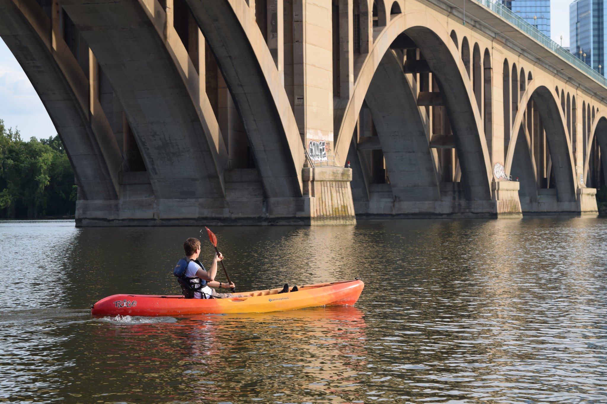
As one of the city’s most beloved parks, Belle Isle is home to one of the most fun, easy hikes in Richmond, VA. A 1.7-mile loop that wraps around the perimeter of the island, this dirt path is flat but offers plenty of fun sights to see, including old industrial warehouses and factories, large boulders and rock formations, and plenty of river access points where you can take a dip or have a picnic. Popular with trail runners and dogs, this is a quintessential spot for hiking in Richmond that you shouldn’t miss!
James River Canal Walk
- Distance from Richmond: 0 miles
- Trail Length: 2.5 miles
- Elevation Gain: Minimal
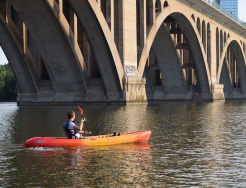
For a more urban stroll on easy, paved terrain, the James River Canal Walk is a fun, historic trail that runs right next to the James River. Along the way, you’ll pass Brown’s Island (home to even more trails and historic areas) and many of the city’s old bridges and tunnels. You’ll also catch several amazing views of the river, too. Visit during the morning or the later hours of the day to catch the sun low in the sky, the perfect time to enjoy the sights and sounds of the river and its surrounding forests.

Pony Pasture
- Distance from Richmond: 0 miles
- Trail Length: 2.1 miles
- Elevation Gain: Minimal
One of the most scenic and unique areas to explore in Richmond is Pony Pasture, which is part of the James River Trail System. This calm section of the James River is full of large rocks and boulders that you can walk on and explore the water. The trail, which offers 2.1 miles of easy, flat terrain, is one of the best hikes in Richmond, VA for views of the James River, as it’s a lot more secluded and forested than the James River Canal. The trail gets very full on warm summer days, so plan to come early and stay a while if you’re hoping to get the most out of this scenic area.

Forest Hill Park Trail
- Distance from Richmond: 0 miles
- Trail Length: 2.7 miles
- Elevation Gain: 278 feet
For a bit more variety in views and terrain than the other easy hikes on our list, head to Forest Hill Park, where you’ll find a little bit of everything on its 2.7-mile loop trail. Waterfalls, still lakes, forests, and boardwalks abound as you make your way through this shady trail. There’s also a little bit of elevation gain for some added fun and challenge. If you choose to explore this trail, watch out for roots, rocks, and other obstacles as the trails narrow - they can cause slipping or tripping and the trails aren’t much wider than one person’s width!

Moderate Hikes Near Richmond, VA
Buttermilk Trail
- Distance from Richmond: 0 miles
- Trail Length: 4.5 miles
- Elevation Gain: 410 feet
One of the most fun and visually stunning places for hiking near Richmond is the moderately difficult Buttermilk Trail. Located on the shores of the James River, this trail features several boulder areas that are fun for scrambling and exploring. With some elevation gain, challenging, rocky terrain, and river areas, the variety on the Buttermilk Trail is what makes it one of the most fun and interesting hiking trails in Richmond. Great for families and hikers looking for a challenge without going too far from the city, the Buttermilk Trail is a fantastic local choice.

Beaver Lake Trail
- Distance from Richmond: 24 miles/35 minutes (Pocahontas State Park)
- Trail Length: 2.3 miles
- Elevation Gain: 170 feet
Pocahontas State Park is one of the most beloved parks in the Richmond area, and the Beaver Lake Trail is just one of its many trails that passes through scenic forests and lakes. Along this 2.3-mile trail, you’ll see a lake with a dam, several forested areas and boardwalks, and some local plant and wildlife viewing opportunities. If you’re looking for something longer, connect this hike with one of the other many trails in the park - there are over 90 miles of trails on the park’s grounds alone!
Note: Pocahontas State Park charges an entrance fee per vehicle - more information here.

Humpback Rocks Loop
- Distance from Richmond: 114 miles/2 hours
- Trail Length: 3.8 miles
- Elevation Gain: 1,122 feet
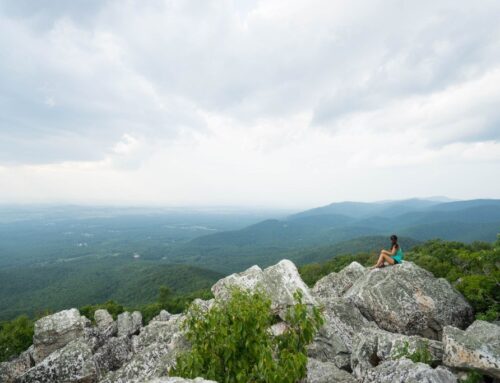
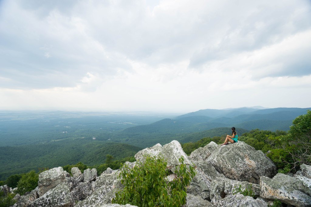
One of the most scenic and popular hikes in the Shenandoah National Park area is Humpback Rocks, a 3.8-mile moderate trail that’s about 2 hours from Richmond. The views are well worth the drive, and the highlight is a rocky outcropping viewpoint that extends out over the mountains as far as the eye can see. Fall is the best time to hike in Shenandoah, but beware that the trails get crowded and it’s best to arrive early during this peak time of year.
It’s a wonderful place for all levels of hikers to try out a more challenging trail, as it’s a fairly short hike compared to others in the area. Plus, getting to experience the striking rock formations amidst the fall leaves in the background? Priceless.
Note: The Blue Ridge Parkway is subject to seasonal road closures. Check for closures here before you go.

Crabtree Falls
- Distance from Richmond: 124 miles/2 hours
- Trail Length: 2.6 miles
- Elevation Gain: 577 feet
Sometimes, all you need is a good waterfall hike to calm the mind and soothe the soul. Crabtree Falls is a wonderful option, and one of the most spectacular waterfall hikes near Richmond that’s suitable for most hikers. The waterfall itself is absolutely spectacular, with the longest drop measuring in at around 400 feet, making it one of the tallest waterfalls east of the Mississippi River.
Although it’s got a fairly steep elevation gain over a short trail, the path is well-maintained and the ascent is gradual. With plenty of switchbacks and good spots to take a break, most hikers (even beginners and children) can make it up to the falls if they take it slowly enough!
Note: There may be seasonal road closures leading to this trail - check here for more information.
Spy Rock Trail via Cash Hallow
- Distance from Richmond: 130 miles/2.5 hours
- Trail Length: 5.8 miles
- Elevation Gain: 1,220 feet
One of the longer moderate trails on our list is the 5.8-mile Spy Rock Trail, which is located along the Appalachian Trail. Situated in the George Washington and Jefferson National Forests, this scenic area is quite rugged and much less crowded than some of the more accessible hikes near Richmond, VA. However, if you’re looking for an adventure, the Spy Rock trail provides access to some fun, challenging terrain and spectacular views of the Blue Ridge Mountains from the top.
Note that the road to access this trail required a 4WD/high clearance vehicle - come prepared with your own or rent an SUV before your trip to ensure your safety!
Difficult Hiking Near Richmond, VA
Old Rag Mountain
- Distance from Richmond: 101 miles/2 hours
- Trail Length: 10.2 miles
- Elevation Gain: 2,650 feet
Possibly the most popular (and one of the most challenging) hikes in Shenandoah National Park, Old Rag can get fairly crowded during the summer months. But for good reason - Old Rag Mountain offers some of the most spectacular views of Shenandoah National Park, and possibly the best on this entire list of places for hiking near Richmond, VA. It’s a whopping 8.6 miles from start to finish, largely uphill, so be sure you’re well stocked with water and snacks before you begin.
Also, it’s important to note that you might think you’ve reached the summit a dozen times before you actually do. Old Rag likes to play tricks on hikers with several false summits. The real summit comes after several scramble areas and has a sign designating it as Old Rag Mountain. You can breathe a sigh of relief once you finally see it!
Note: Shenandoah National Park charges an entry fee, which you can find information on here.

Whiteoak Canyon
- Distance from Richmond: 116 miles/2.5 hours
- Trail Length: 9.5 miles
- Elevation Gain: 2,408 feet
Arguably one of the most epic waterfall hikes near Washington DC, the Whiteoak Canyon Trail is a challenging and stunningly beautiful 9.5-mile trail where you’ll definitely get your fill of waterways and falls. Located in Shenandoah National Park, this trail is one of the best spots for hiking near Richmond, VA to visit as part of a longer weekend trip in the park.
During the course of the Whiteoak Canyon Trail, you’ll get to see a total of 8 waterfalls of varying sizes and strength. If you’re hoping to catch some good photography opportunities, go during the fall when the leaves turn all kinds of bright and beautiful warm colors.
Note: Shenandoah National Park charges an entry fee, which you can find information on here.

Devils Marbleyard
- Distance from Richmond: 155 miles/2.5 hours
- Trail Length: 4.5 miles
- Elevation Gain: 1,463 feet
If scrambling is your jam, then the Devils Marbleyard Trail is for you! Located in the Blue Ridge Mountains, this trail requires a lot of strength and stamina to hike and scramble up nearly 1,500 feet. It’s one of the toughest hikes near Richmond, VA, but it’s also one of the most fun.
The “marbleyard” is a large boulder field that stretches straight up the side of the mountain that - you guessed it - intrepid hikers have to scramble to get to the top. There’s no final landmark that signals the end of the trail; rather, there’s a point near the top of the scramble that overlooks the entire boulder field and the mountains beyond. It’s definitely not for the faint of heart, but it’s a fun challenge for hikers who are seeking a thrilling trail!
Additional Resources for Hiking Near Richmond, VA
What to Pack
- Breathable hiking clothes - For warmer hikes, you’ll want to wear a sweat-wicking shirt and breathable pants, like these Patagonia hiking shorts for men and women. For cold-weather hikes, we recommend dressing in layers, including merino wool baselayers for men and women, a down puffer jacket for men and women, and a Northface waterproof outer shell for men and women (a must for hiking in Seattle). And don’t forget a pair of the best women’s and men’s hiking socks!
- Trekking poles - You won’t need these for every single hike, but we suggest throwing them in your car just in case. We recommend the Black Diamond Trail Ergo cork trekking poles, which are lightweight, easy to transport, and durable.
- Water bottle - Having water available at all times is a huge must. To limit disposable plastic, we recommend bringing your own refillable water bottle. We’re obsessed with Hydro Flask water bottles because they keep water cold for hours.
- Sunscreen and bug spray - Sweatproof sunscreen and DEET bug spray can help you avoid sunburn and bug bites, two of hiking’s most annoying after-effects. Our favorite kind of sunscreen is Sun Bum, as it is free of harsh chemicals and safe for marine life, including coral reefs.
- A brimmed hat or cap - The sun can be brutal in open hikes, so always pack a brimmed hat or cap for day hikes in the sunshine.
- Emergency blanket and first aid kit - We’d strongly recommend bringing a first aid kit and a lightweight emergency blanket on every hike. Why? Because the unfathomable can happen, and it’s always best to play it safe.
- Durable day pack - A durable day pack is the perfect spot to stash all your hiking gear. While any backpack will do, we recommend the Osprey Tempest 20 or the Talon 22 day packs because they’re comfortable and breathable for long hikes. For more information, check out our best day packs for any terrain guide.
Wondering what exactly you should pack for your next hike? Visit our Complete Day Hiking Packing List for our full list and our top gear recommendations.

