Updated November 16, 2025
Known for its beaches and laid-back vibes, San Diego is a heavenly city for outdoor lovers. Even if you’re not a surfer, there are tons of ways to explore the outdoors in the city, and hiking in San Diego is one of them. With a wide variety of terrain in the city and its surrounds, hikers will find trails ranging from wildlife-rich nature preserves to challenging summit scrambles. A short drive from downtown San Diego can take you to beaches, deserts, mountains, and more! To help you plan your next adventure, we created this guide with 21 of the most breathtaking hikes in San Diego and the surrounding areas. (Let us know if we missed your favorite!)
NOTE: Some of these trails may be closed currently due to safety concerns regarding the current global pandemic. Head to the San Diego Parks website to get the latest information.
Make sure you’re prepared for the San Diego weather with the proper hiking clothes! Check out our complete guide for the best gear and clothes for hiking in the fall.

Easy Hikes in San Diego
Torrey Pines Beach Trail
- Trail Distance: 2.3 miles
- Trailhead Location: Torrey Pines Park Road (Torrey Pines State Park)
If you’re seeking one of the most iconic hikes in San Diego, the Torrey Pines Beach Trail is it. Here, you’ll find beautiful seaside bluffs towering over the crashing waves of the Pacific on a flat, easy trail that’s perfect for hikers of all levels, including children! The sweeping views of the coastline are well worth the hike itself, but as a bonus, you’ll also wander through magnificent rock formations and wildflower meadows, too.
We’d recommend hiking at Torrey Pines in the evening to enjoy the sunset over the coast, but mornings can be nice with fewer crowds. On the trail, there’s very little shade, so we’d recommend bringing a hat and sunscreen if you choose to go then.
Note: There is a fee to park in the main parking area.
Big Laguna Trail
- Trail Distance: 13.3 miles
- Trailhead Location: Turn off Sunrise Hwy to Laguna Meadow Rd (Cleveland National Forest)
For a day-long adventure on an incredibly scenic San Diego hiking trail, look no further than the Big Laguna Trail. The trail runs along the peaceful shores of Little Laguna and Big Laguna Lakes, with plenty of shade from the local evergreen forests. The trail boasts some serious alpine vibes, even in the winter when there’s snow on the ground. You might even forget you’re in Southern California! Locals absolutely love the Big Laguna Trail, and many cite it as one of their absolute favorite hikes in San Diego. Needless to say, this is one you definitely shouldn’t miss!

Palm Canyon Loop
- Trail Distance: 2 miles
- Trailhead Location: S. Palm Canyon Drive (Agua Caliente Band of Cahuilla Indians Reservation)
Welcome to a desert oasis - the Palm Canyon Loop trail! Yes, this trail is home to an actual desert oasis, featuring towering palm trees, glimmering streams, and eerie rock formations. The unique scenery here definitely puts it on the radar as one of the top hikes in San Diego - it’s a pocket of paradise in the otherwise parched terrain of the Palm Springs desert. Because the trail is fairly flat, it’s perfect for hikers of all levels to get out in the wilderness. Local hikers love the Palm Canyon Loop trail because it’s short, easy, and has lots of vibrant and picturesque scenery along the way.
Note: There is a $9 entrance fee per adult, a $5 fee per child (6-12), and a $7 fee per senior (62+) or student.

Los Penasquitos Canyon Trail
- Trail Distance: 7.4 miles
- Trailhead Location: Intersection of Black Mountain Road and Mercy Road (Los Penasquitos Canyon Preserve)
Located in a wide canyon, the Los Penasquitos Canyon Trail is one of the absolute best places for hiking in San Diego. This multi-use trail runs through wooded areas, vast meadows, and culminates in a quaint waterfall. It’s also flat the whole way, so it’s great for beginners as well as more experienced hikers. Note that because this trail is used by hikers, runners, bikers, etc., it can become very crowded on weekends. Visitors love that this trail is longer with easy terrain, perfect for a longer day of hiking and enjoying the scenery.
Note: There is a $3 parking fee in the parking lot. Also, this trail may be closed because of flooding or damage - check here for the latest status.
Blue Sky Ecological Reserve
- Trail Distance: 3.7 miles
- Trailhead Location: Espola Road (Blue Sky Ecological Reserve)
If it’s a more forested hiking trail you’re seeking, the Blue Sky Ecological Reserve is one of the shadier hikes in San Diego that’s perfect for hikers of all levels. Towering, old oak trees provide a cool canopy over the trail, which boasts a view of Lake Ramona if you hike all the way in. The reserve also offers a variety of programming for visitors, like guided docent tours and frequent nature education events. Because of the variety of trails and things to do, this is an especially nice hike for families with children.

Batiquitos Lagoon Trail
- Trail Distance: 3.3 miles
- Trailhead Location: End of Gabbiano Lane (Carlsbad, CA)
For wildlife lovers, there are few better places for hiking near San Diego than the Batiquitos Lagoon Trail. This marshy area is home to many local species of birds, marine life, and plants, which you can learn more about on this 3.1 mile trail. For families and avid nature lovers, there’s an adjacent Nature Center with tons of information on the different species you can find in the lagoon. Additionally, the lagoon itself is quite picturesque, and worth the hike on its own!

Moderate Hikes in San Diego
Cuyamaca Peak Loop Trail
- Trail Distance: 7.7 miles
- Trailhead Location: Highway 79, turn to find the trailhead - GPS: 32.96022, -116.58021 (Cuyamaca Rancho State Park)
As one of the highest peaks in San Diego County, there’s no shortage of awesome views or spectacular scenery on the Cuyamaca Peak Loop Trail. With its beautiful, old trees, sweeping valley views, and gentle incline, this is one of the most accessible and worthwhile hikes in San Diego for all levels.
On the trail, you’ll find wooded sections interspersed with views of the surrounding mountains along the 7.7 miles of this loop trail. Hikers mention that the trails can get quite muddy after periods of rain, so it’s a good idea to wear waterproof hiking boots and trekking poles.
Stonewall Peak Trail
- Trail Distance: 3.4 miles
- Trailhead Location: Highway 79, across from the Cuyamaca Peak trailhead (Cuyamaca Rancho State Park)
For a short hike with a gentle incline and views for miles, the Stonewall Peak trail is a fun challenge for hikers of all levels. Located just across the highway from the Cuyamaca Peak trail head, the Stonewall Peak trail offers stunning views of Cuyamaca Rancho State Park. Along the trail, you’ll come across several gentle switchbacks that lead to the peak. While the switchbacks can feel arduous and repetitive, the panoramic views from the top are well worth the effort!
Note: There is a day-use fee per vehicle at Cuyamaca Rancho State Park.

Cowles Mountain
- Trail Distance: 3 miles
- Trailhead Location: Intersection of Navajo Road and Golfcrest Drive (Mission Trails Regional Park)
Cowles Mountain is the highest peak in San Diego County, and the trail here takes you all the way up to the top. This short trail is rated as moderate and is one of the best hikes in San Diego for all levels, giving hikers the chance to experience some of the best views in the city without having to scramble. Note that this is one of the most popular trails in San Diego, and it gets extremely crowded on weekends. Your best bet is to go early in the morning for optimal views and minimal crowds.
Iron Mountain Trail
- Trail Distance: 5.2 miles
- Trailhead Location: Near intersection of Poway Rd and Highway 67 (Poway, CA)
According to locals, the Iron Mountain trail ranks among the top mountain hikes in San Diego for its views alone. Located in nearby Poway, this hike features a challenging ascent leading up to a panoramic viewpoint of the surrounding mountaintops and valleys. The uphill can be tricky, but many hikers say that the downhill can be even more tricky, as the steep slopes can cause slippage and often get muddy after rains. Bring trekking poles if you think you’ll want extra support for the descent!

Cedar Creek Falls
- Trail Distance: 5.6 miles
- Trailhead Location: End of Thornbush Road (Cleveland National Forest)
Be prepared to get wet if you’re hiking the Cedar Creek Falls trail! This hilly trail through Cleveland National Forest has three stream crossings, which can be higher than knee-deep depending on how wet the area is from recent weather. This trail ends in a pretty waterfall that is best visited after periods of rain (sometimes the flow trickles in drier weather). Along the way, you’ll find lovely, colorful patches of wildflowers, rock pathways, and lovely views.
Note: This trail now requires a permit to hike it. You can purchase it here before you hike.

Oak Canyon Trail
- Trail Distance: 3.2 miles
- Trailhead Location: Mission Trails Regional Park
The Oak Canyon Trail is another trail in Mission Trails Regional Park that’s suitable for all levels. Here, you’ll find rock canyon areas, small ponds, and wide meadows, a wonderful balance of terrain for beginners to advanced hikers. For a longer hike, you can tackle the Oak Canyon to Grasslands trail, which spans 3.7 miles and tracks through even more wildflower-laden meadows! Hikers especially love this trail for families and children, since there are so many places to explore and the ascents/descents aren’t too difficult.
Lake Hodges Overlook
- Trail Distance: 7.3 miles
- Trailhead Location: Off Harmony Grove Rd in Escondido, CA (Elfin Forest Recreational Reserve)
The Lake Hodges Overlook is a moderate, accessible hike for all levels that brings you to a panoramic view of Lake Hodges and the Escondido area. The beginning of the trail is fairly steep and has several areas with switchbacks, but after that it’s a very manageable, gradual incline to the top, where you’ll see breathtaking views of the lake and its surrounding hills.
Note that this trail is quite exposed, so hiking in mid-afternoon direct sunlight is not recommended. If you do choose to hike in the sun, wear sunscreen, sunglasses, and a wide brimmed hat.

Three Sisters Falls Trail
- Trail Distance: 4.1 miles
- Trailhead Location: Trailhead begins on Boulder Creek Road in Descanso (Cleveland National Forest)
For multiple waterfalls on one single trail, the Three Sisters Falls trail is a fantastic, moderate hike with a lot of picturesque cascades. This trail begins on a downhill into the canyon where the waterfalls are located, then an uphill on the return trip. You’ll find unique-looking waterfalls that flow through the surrounding rocks, and you can also take a dip in the pools as a reward for hiking.
Maidenhair Falls & Lower Hellhole Canyon
- Trail Distance: 5.6 miles
- Trailhead Location: Anza-Borrego Desert State Park
The name probably doesn’t sell you on the hike, but trust us, this is one worth doing! You’ll hike through the Hellhole Canyon trail, which, as its name implies, is very hot and has no shade. You’ll soon come across three separate palm groves that eventually clear out for a small waterfall, making for a pleasing reward after a tough hike. Make sure to bring sunscreen and plenty of water! This trail is best hiked in the cooler months, between October and May.

Difficult Hikes in San Diego
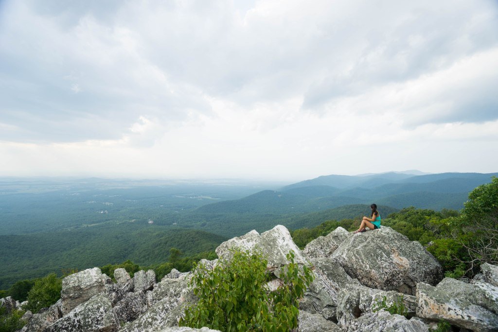
Potato Chip Rock (Mt. Woodson)
- Trail Distance: 7.3 miles
- Trailhead Location: End of Lake Poway Road in Lake Poway Park
A picturesque and uniquely shaped rock sits at the end of the Potato Chip Rock Trail, offering a nice reward for those brave enough to tackle this challenging uphill hike. A 2,000+ ft elevation change lies in store, so be prepared for an intense climb. Much of the trail is exposed so be sure to bring plenty of sunscreen. The potato chip makes for great pictures, and you can even get on top of it, if you’re brave enough to take a little jump to it.
Note: Parking is $10 for non-Poway residents on weekends and holidays.
Corte Madera Mountain Trail
- Trail Distance: 6.7 miles
- Trailhead Location: Cleveland National Forest
Offering gorgeous views of the lush green forest below, Corte Madera Mountain is a must-do hike near San Diego. Most of the trail is relatively easy, but there are a few tough uphill sections that may limit the beginner hiker. The trail is very well marked, making it difficult to get lost. Be sure to wear long pants and a long shirt since the brush can get very dense in some parts. Part of the trail will take you through manzanita forests, boulder fields, and desert brush. Beware of wildlife as bobcats have been known to wander through the area!

El Cajon Mountain Trail
- Trail Distance: 11.3 mile
- Trailhead Location: El Capitan County Preserve
One of San Diego’s more challenging hikes, El Cajon Mountain will taunt you with several false peaks and uphill sections both up the mountain and back down. This trail is a serious challenge and a must for anyone looking for challenging hikes near San Diego. The hike starts with a smooth ascent along a paved road but will soon transition into some switchbacks. Don’t start swearing at the switchbacks though, because these are the only ones you’ll get the whole trail. Much of the rest of the hike is a straight up steep ascent to the top. Stunning views begin about halfway up. On clear days, you can see the Pacific ocean in the distance.
Split Mountain
- Trail Distance: 11.4 miles
- Trailhead Location: Anza-Borrego Desert State Park
Not to be confused with the other Split Mountain in California, Southern California’s Split Mountain offers stunning and secluded views of the desert plains. The trail is wide and you’ll often see Jeeps and other sport utility vehicles tackle the terrain alongside hikers. The highlight of the trek is the last part where you hike through a prehistoric graveyard of seashells. Yes, you read that correctly. Millions of years ago this place used to be underwater. We recommend going in the Winter and early Spring due to the heat.

Whale Peak
- Trail Distance: 8.8 miles
- Trailhead Location: Anza-Borrego Desert State Park
Take a spectacular hike through the desert wilderness up Whale Peak. This trail is for experienced hikers and requires trail finding, GPS navigation, and a high clearance vehicle. Beware: navigating apps have been known to take you to the wrong trailhead. Be sure to turn onto the first dirt road off of S2 after Scissors Crossing, and not the second road.
The trail will take you initially through a desert climate and will gradually transition into an alpine climate as you make your way up the mountain. You’ll pass several false summits and eventually climb a scramble up to the true summit. The views at the top are absolutely fantastic. Attempt this trail in the cooler months.
Additional Resources for Hiking in San Diego
What to Pack for Hiking in San Diego
- Breathable hiking clothes - For warmer hikes, you’ll want to wear a sweat-wicking shirt and breathable pants, like these Patagonia hiking shorts for men and women. For cold-weather hikes, we recommend dressing in layers, including merino wool baselayers for men and women, a down puffer jacket for men and women, and a Northface waterproof outer shell for men and women (a must for hiking in Seattle). And don’t forget a pair of the best women’s and men’s hiking socks!
- Trekking poles - You won’t need these for every single hike, but we suggest throwing them in your car just in case. We recommend the Black Diamond Trail Ergo cork trekking poles, which are lightweight, easy to transport, and durable.
- Water bottle - Having water available at all times is a huge must. To limit disposable plastic, we recommend bringing your own refillable water bottle. We’re obsessed with Hydro Flask water bottles because they keep water cold for hours.
- Sunscreen and bug spray - Sweatproof sunscreen and DEET bug spray can help you avoid sunburn and bug bites, two of hiking’s most annoying after-effects. Our favorite kind of sunscreen is Sun Bum, as it is free of harsh chemicals and safe for marine life, including coral reefs.
- A brimmed hat or cap - The sun can be brutal in open hikes, so always pack a brimmed hat or cap for day hikes in the sunshine.
- Emergency blanket and first aid kit - We’d strongly recommend bringing a first aid kit and a lightweight emergency blanket on every hike. Why? Because the unfathomable can happen, and it’s always best to play it safe.
- Durable day pack - A durable day pack is the perfect spot to stash all your hiking gear. While any backpack will do, we recommend the Osprey Tempest 20 or the Talon 22 day packs because they’re comfortable and breathable for long hikes. For more information, check out our best day packs for any terrain guide.
Wondering what exactly you should pack for your next hike? Visit our Complete Day Hiking Packing List for our full list and our top gear recommendations.


