Updated November 17, 2022
Located in the southern part of the Bay Area, San Jose often gets overshadowed by its northern neighbor, San Francisco. Most people know the San Jose area as home to tech giants like Apple and Facebook, but there are plenty of other things to love about San Jose, including its wonderful access to nature! If you look closely, you’ll find dozens of wonderful parks and nature areas to go hiking near San Jose, perfect for a post-work break or a weekend of adventuring. Old mining structures, bald mountaintops, and rocky outcroppings provide plenty of incredible views and terrain to explore. We created this guide to the best hikes near San Jose, CA to help you plan your next outdoor adventure!

Easy Hiking Near San Jose, CA
Almaden Lake Loop
- Distance from San Jose: 0 miles
- Trail Length: 1.4 miles
- Elevation Gain: Minimal
Hikers of all experience levels will enjoy the beautiful Almaden Lake Loop, one of the more popular spots for hiking in San Jose. This paved trail is more like a suburban nature walk than a traditional hike, but it’s a great place for getting some fresh air and enjoying the beautiful scenery surrounding Almaden Lake. There are also plenty of nice benches to perch yourself on if you want a break or enjoy people watching along the waterfront! Perfect for families with young children or strollers, you’ll often find a good number of people on this trail during peak times.
Eagle Rock
- Distance from San Jose: 0 miles
- Trail Length: 4.1 miles
- Elevation Gain: 856 feet
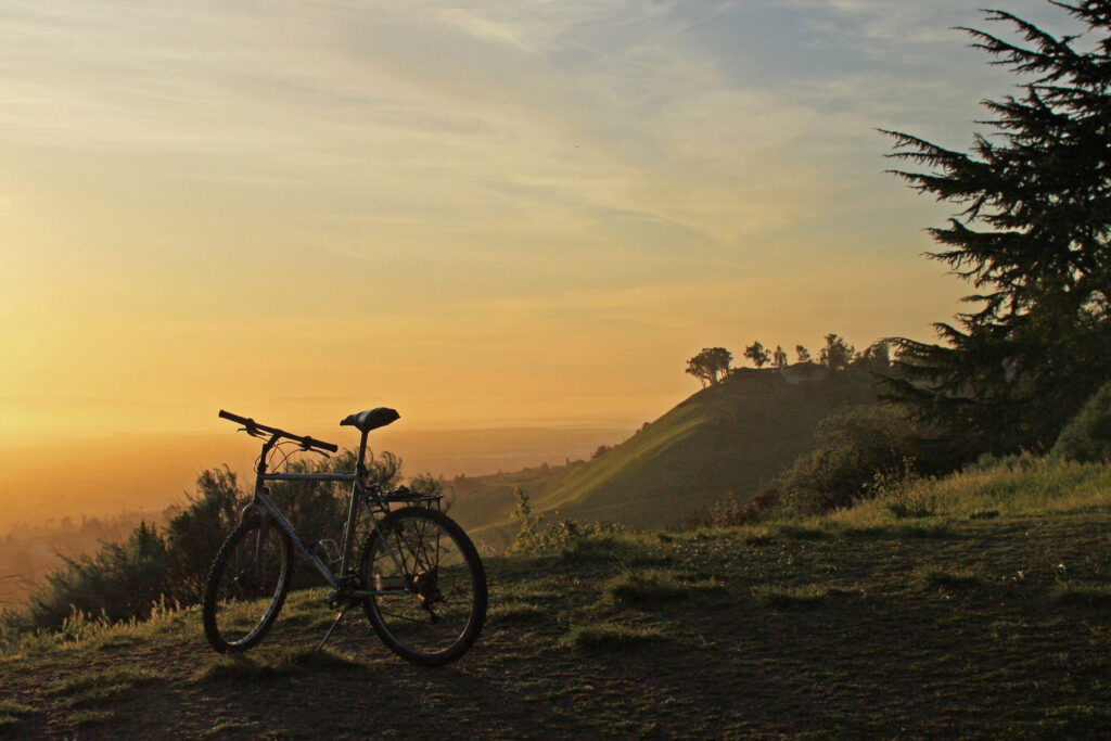
One of San Jose’s most memorable peaks, Eagle Rock, is an easy to moderate trek from the base of the mountain. This sunny trail can get crowded during the day, but it’s especially suited for crowds because it is wider than most hiking trails. There’s very little shade along the trail, so we’d recommend going early in the morning or just before sunset to protect yourself from the sun’s harsh rays. From the top, you’ll find panoramic views of San Jose and the surrounding peaks, a wonderful reminder that there’s so much great nature right in the middle of the city!

Bayview and Meadowlark Loop
- Distance from San Jose: 23 miles/35 minutes (Coyote Hills Regional Park)
- Trail Length: 4.9 miles
- Elevation Gain: 282 feet
If it’s bird’s eye views and waterfront panoramas you seek, but don’t want a strenuous trail, the Bayview and Meadowlark Loop at Coyote Hills Regional Park is a fantastic option. At just under 5 miles, this is the longest easy trail on our list, perfect for taking a few hours to wander through the park’s scenic trails that overlook the bay. The paths here are mostly paved and are built extra wide to accommodate the many locals who traverse this trail regularly. Come at sunset for some spectacular views over the water and to avoid the mid-day sun.

Penitencia Creek Trail
- Distance from San Jose: 8 miles/30 minutes
- Trail Length: 3.5 miles
- Elevation Gain: 262 feet
Alum Rock Park is a really popular local park for getting outdoors, and its Penitencia Creek Trail is one of the most beloved easy hikes in San Jose. Although the trail is relatively flat, it offers really nice views of the valleys and passes through some really cool rock formations. Additionally, it’s a partially shaded trail, unlike many of the others on our list, which means it’s suitable for daytime hiking (if you can stand the heat!).
Note: Alum Rock Park charges a $6 fee to park.

Aquila Loop Trail
- Distance from San Jose: 12 miles/30 minutes (Sierra Vista Open Space Preserve)
- Trail Length: 1.1 miles
- Elevation Gain: 131 feet
For a short, open trail loop through the Sierra Vista Open Space Preserve, the Aquila Loop Trail is a great option. The Aquila Trail offers exactly what the park’s name advertises – open space and mountain views. On clear, fog-less days, you can see the golden hills rolling throughout the park, a beautiful contrast to the many waterfront views and rocky mountains you typically see on hikes in the northern California area. Bring lots of water for this trail, as it’s completely exposed and dry, especially during the hotter times of day.

Moderate Hikes Near San Jose
Santa Teresa County Park Loop
- Distance from San Jose: 0 miles
- Trail Length: 8.3 miles
- Elevation Gain: 1,768 feet
A quieter, moderately difficult hike through Santa Teresa County Park is its namesake loop trail, which winds 8.3 miles across the park’s many hilltop vistas. It’s a partially shaded hilltop hike that’s especially beautiful at sunset, when the sky turns all kinds of pastel colors across the Bay Area. From the top, you’ll see wide open views of the surrounding hills in the park, the nearby mountains faded blue in the distance, and the valleys and buildings in San Jose below. It’s a really special spot for hiking in San Jose, and many locals return more than once to enjoy the sweeping vistas of the area.
Senador Mine to Mine Hill Loop
- Distance from San Jose: 0 miles
- Trail Length: 14.0 miles
- Elevation Gain: 2,253 feet
Alternatively known as the Quicksilver Loop, the Senador Mine to Mine Hill Loop is a historic mining area that’s since been converted to a park and hiking trail. There’s a lot of variety on this 14-mile trail, from old mining structures to shimmering azure lakes and, of course, some lovely mountain views of nearby peaks. Along the paths, you’ll find a few plaques that offer some of the history of the area. We’d recommend tackling this trail in the late afternoon when the sun is low in the sky.

Boccardo Loop
- Distance from San Jose: 12 miles/30 minutes (Sierra Vista Open Space Preserve)
- Trail Length: 4.3 miles
- Elevation Gain: 994 feet
You’ll probably notice a theme between many of the hikes on our list – scenic leg burners through the hilltops surrounding the Bay Area. The Boccardo Loop in Sierra Vista Open Space Preserve is yet another one of these, but at 4.3 miles, it’s a little bit shorter than some of the other hikes on our list. This trail runs through farm land, so it’s got a little bit more of a rustic, provincial vibe to it than some of the more mountainous trails. However, on clear mornings and evenings, you’ll find few views on hikes near San Jose as magical as these.
Seven Springs Loop Trail
- Distance from San Jose: 16 miles/30 minutes
- Trail Length: 2.6 miles
- Elevation Gain: 561 feet
Finally, a trail that’s mostly shaded! The Seven Springs Loop Trail is one of the few hikes near San Jose that’s got decent tree cover, so it’s great for lazy mornings where you want to hike but don’t want to get too much sun exposure. From this short trail, you’ll find lovely panoramic views of the Bay area with a little less elevation gain than many of the other hikes on our list. If you’re a beginner looking to try some more challenging hikes, or just want a more leisurely yet still challenging trail to tackle on a weekend day, the Seven Springs Loop is a great choice for hiking near San Jose.

Black Mountain via Rhus Ridge
- Distance from San Jose: 17 miles/20 minutes
- Trail Length: 9.2 miles
- Elevation Gain: 2,506 feet
For those willing to hike its 9.2 miles, the Black Mountain summit trail offers some of the best views of San Jose and Silicon Valley of any of the hikes on our list. But beware: this hike isn’t for the faint of heart. The trail is almost 100% exposed and there are no points to stop for water (so bring much more than you think you’ll need). It’s a real leg burner, with very steep ascents for a total elevation gain of over 2,500 feet. But if you make it to the top, be prepared for some astoundingly beautiful views of the Bay Area and the rest of the mountaintop.
Ridge, Blackhawk and Sprig Trail Loop
- Distance from San Jose: 33 miles/45 minutes (Mount Madonna County Park)
- Trail Length: 5.2 miles
- Elevation Gain: 1,204 feet
If you’ve been hiking near San Jose a few times, you may have started to crave a bit of a change in scenery. Although they’re just 45 minutes from San Jose, the Ridge, Blackhawk and Sprig Trails at Mount Madonna County Parks offer a different set of views than your typical hikes near San Jose.
Compared to others on our list, the trail is heavily forested with evergreen trees and tons of shade, and feels a bit more like an alpine haven than a trek along hilltops. Moreover, you’ll get to walk through a magnificent Redwood forest, with towering trees surrounding you and swaying in the breeze. It’s a surreal experience that you can’t miss!

Mount Umunhum
- Distance from San Jose: 20 miles/40 minutes
- Trail Length: 7.7 miles
- Elevation Gain: 1,187 feet
A local favorite, Mount Umunhum is one of the most beloved hikes near San Jose, and for good reason – it’s got shade, it’s got views, and the incline is gradual enough to make the hike up more pleasant than it is strenuous. At 7.7 miles, this trail isn’t exactly short, but because the ascent isn’t too steep, it’s quite attainable for most hikers willing to go the distance. On the trail, you’ll pass the “cube,” an abandoned historic radio building that looks eerily brutalist. You’ll also catch some of the best mountain views in the area on clear days.

Difficult Hikes Near San Jose, CA
Berry Creek Falls Loop
- Distance from San Jose: 37 miles/1 hour (Big Basin Redwoods State Park)
- Trail Length: 13 miles
- Elevation Gain: 2,335 feet
If you’re looking for cool, shady hiking near San Jose, look no further than the Berry Creek Loop in Big Basin State Park. This 11.2 mile trail winds through the Redwood forest and brings hikers to a lovely waterfall. The Berry Creek waterfall is stunning and the hike to get there provides a challenge that’s accessible to even less-experienced hikers (with some patience and grit!). Along the way, you’ll find wooded trails, scenic bridges, and some views of the city and the surrounding nature areas.
Note: As of November 2021, this trail is closed. Check here for updates on when/if it opens again.
New Almaden Trail
- Distance from San Jose: 13 miles/24 minutes
- Trail Length: 14.2 miles
- Elevation Gain: 2,093 feet
For a long, challenging trail through the mountains that’s mostly shaded, the New Almaden Trail is a popular spot for hiking near San Jose, especially for locals. This 14.2 mile loop trail is part loop and part out-and-back, so you can really choose your own adventure here. From the trail, you’ll catch sweeping vistas of the surrounding mountains, nearby rivers, and the valley below. With plenty of steep sections and varied terrain, experienced hikers and trail runners will enjoy the length and variety of this local San Jose hiking trail.

Mission Peak
- Distance from San Jose: 16 miles/20 minutes
- Trail Length: 5.8 miles
- Elevation Gain: 2,135 feet
Many hikes near San Jose offer challenging ascents, but few are quite as tough on the legs as Mission Peak. This mountain hike brings hikers up to the top of a mountain by way of steep, exposed ascents that offer little shade and spellbinding views of the bay. Getting to the top heeds huge rewards for those willing to put in the effort, with beautiful views of the Bay Area all the way out to the water. The best time to do this hike is around sunset, when the sky turns golden and lights up the horizon in shades of honey and orange.
Additional Resources for Hiking Near San Jose
What to Pack
- Breathable hiking clothes – For warmer hikes, you’ll want to wear a sweat-wicking shirt and breathable pants, like these Patagonia hiking shorts for men and women. For cold-weather hikes, we recommend dressing in layers, including merino wool baselayers for men and women, a down puffer jacket for men and women, and a Northface waterproof outer shell for men and women (a must for hiking in Seattle). And don’t forget a pair of the best women’s and men’s hiking socks!
- Trekking poles – You won’t need these for every single hike, but we suggest throwing them in your car just in case. We recommend the Black Diamond Trail Ergo cork trekking poles, which are lightweight, easy to transport, and durable.
- Water bottle – Having water available at all times is a huge must. To limit disposable plastic, we recommend bringing your own refillable water bottle. We’re obsessed with Hydro Flask water bottles because they keep water cold for hours.
- Sunscreen and bug spray – Sweatproof sunscreen and DEET bug spray can help you avoid sunburn and bug bites, two of hiking’s most annoying after-effects. Our favorite kind of sunscreen is Sun Bum, as it is free of harsh chemicals and safe for marine life, including coral reefs.
- A brimmed hat or cap – The sun can be brutal in open hikes, so always pack a brimmed hat or cap for day hikes in the sunshine.
- Emergency blanket and first aid kit – We’d strongly recommend bringing a first aid kit and a lightweight emergency blanket on every hike. Why? Because the unfathomable can happen, and it’s always best to play it safe.
- Durable day pack – A durable day pack is the perfect spot to stash all your hiking gear. While any backpack will do, we recommend the Osprey Tempest 20 or the Talon 22 day packs because they’re comfortable and breathable for long hikes. For more information, check out our best day packs for any terrain guide.
Wondering what exactly you should pack for your next hike? Visit our Complete Day Hiking Packing List for our full list and our top gear recommendations.

