Updated July 21, 2025
Toronto may be Canada’s most populated city, but it’s also got a surprisingly wide variety of outdoor adventures within reach. From skiing to running to hiking and biking, there are plenty of ways to explore the outdoors in and around the Toronto area. Hiking in Toronto is one of the easiest and most accessible ways to get some fresh air and learn more about this amazing city. With historic and industrial areas, mountain trails, and rocky cliffsides, the hikes in Toronto vary from easy, leisurely walks to strenuous hikes and scrambles. We created this guide to the best places to go hiking near Toronto so you can plan your next outdoor adventure!
Want to make sure you have all the gear you need for your hike? Check out our complete day hiking packing list.

Easy Hiking in Toronto
Evergreen Brickworks
- Trail Length: 2.4 kilometers
- Elevation Gain: Minimal
Located in the heart of Toronto, Evergreen Brickworks is an urban community space that occupies a former farm and brick factory that was built in the 1880s. Today, it offers community gathering spaces, as well as several footpaths and trails that are accessible to hikers of all levels and families so that they can get to know the vast outdoor and environmental opportunities in the Don River area.
The park’s paved trails wind through some of the old industrial structures of the original brick factory, as well as several green spaces. Perfect for a short stroll or an afternoon fresh air break, this unique hike is an easy way to go hiking in Toronto without leaving the city!
High Park Trails
- Trail Length: 5.3 kilometers
- Elevation Gain: 56 meters
For a more nature-infused outdoor experience, High Park is home to some of the most scenic urban hikes in Toronto. Located in the city, High Park’s paved paths offer an accessible and easy option for all levels, including children and dogs! The paths pass by the peaceful Grenadier Pond and through miles of shady forested areas, perfect for an early morning walk or a mid-day stroll. Because its mission is to help Toronto locals learn about the environment, the park also offers lots of classes about the outdoors, wildlife, and gardening.

East Don Parkland
- Trail Length: 10.9 kilometers
- Elevation Gain: 86 meters
Situated in the outskirts of the city, the East Don Parkland trail is a wonderful and convenient place to go hiking in Toronto. Located on the Don River Watershed, the park area consists of several waterways that all flow into Lake Ontario. For hiking, the trails here are flat and easy, and are heavily forested with lots of wildlife. On a hike through, you’ll encounter some very picturesque historic bridges, tons of waterways, and paved pathways perfect for hikers of all levels.

West Humber River Recreation Trail
- Trail Length: 19 kilometers
- Elevation Gain: 94 meters
If you’re looking for a longer urban trail for hiking in Toronto, West Humber River Recreation Trail is a fantastic option for you. Running along the peaceful West Humber River, you can typically find several Toronto locals here running, walking, or biking. The paved pathways of this 11.8-mile trail are perfect for hikers of all levels, as well as children and dogs. Along the way, you’ll find recreation areas, wooded patches, scenic waterways and bridges, and opportunities for wildlife viewing.
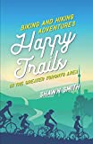
In this article, we’ve covered some of the main trails, green spaces, and hikes in Toronto and the surrounding areas, but we can’t include everything. If you’re interested in learning about even more trails in the area, we’d recommend picking up a copy of Happy Trails: Biking and Hiking Adventures in the Greater Toronto Area.

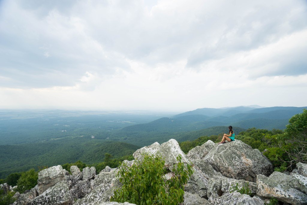
Scarborough Bluffs Trail
- Trail Length: 6.8 kilometers
- Elevation Gain: Minimal
Perhaps one of the most picturesque easy hikes in Toronto, Scarborough Bluffs looks like a landscape out of Greece or California. With towering, rugged cliffs bordering turquoise blue lake waters, this stunning recreation area is perfect for photographers or hikers seeking a true break from the city grind.
Located along Lake Ontario, the trail leads you down to a small lakeside beach, where you can wander and view the amazing bluffs (just don’t climb them, or you’ll face a hefty fine). As Scarborough Bluffs is one of the most popular day trips from Toronto, we’d strongly recommend going early in the morning to avoid heavy crowds along the trails.
Blue Mountain Cascade Trail
- Trail Length: 3.5 kilometers
- Elevation Gain: 283 meters
It may be short, but the Blue Mountain Cascade Trail is one of the prettiest hikes in Toronto. Passing through 2.2 miles of forests, meadows, and scenic waterfalls, the trail is a perfect escape from the chaos and noise of the city. While there is a steeper incline on this trail than others on our “Easy Hikes” list, the trail is fairly easy and accessible to all levels of hikers. Plus, the rewards (and photo opportunities) of the surrounding scenery are well worth the hike.
Note: As of July 2021, some sections of this trail may be closed. Be sure to check for any updates on park closures before you go.

DeCew Falls
- Trail Length: 2.3 kilometers
- Elevation Gain: Minimal
Note: As of June 2020, the DeCew Falls section of the Bruce Trail is closed. For the latest information on trail closures, click here.
DeCew Falls is one of the most unique hikes in Toronto for nature and history lovers alike. Beginning at the Morning Star Mill, this beautiful trail passes through the forest to a scenic view of Twelve Mile Creek and some very beautiful waterfalls. For an extra challenge, hike down to the creek so you can get a closer look. Note that this trail can get a little slippery and muddy, so it’s important to wear solid hiking boots and avoid after heavy rainfall.
Rouge Valley Vista Trail
- Trail Length: 9 kilometers
- Elevation Gain: 145 meters
For a tranquil outdoor getaway that’s not far from the city, the Rouge Valley Vista Trail is a fantastic place to experience the natural attractions that Toronto has to offer. Located in Rouge National Forest Park, this wooded trail is quiet and peaceful, and offers lovely views of the creeks nearby, especially in the fall when the leaves blaze red, orange, and yellow. Many locals cite the Rouge Valley Vista Trail as one of their favorite hikes in Toronto (and with so many hikes to do, that’s pretty high praise!).

Mount Nemo
- Trail Length: 5.3 kilometers
- Elevation Gain: 81 meters
If you’re a hiking beginner but want to summit a mountain, Mount Nemo is one of the most accessible summit hikes in Toronto and the surrounding areas. This forested trail is just 3.3 miles, but will take you up to the summit of Mount Nemo, which boasts views of the Toronto skyline and the nearby countryside on clear days. The best time to hike the Mount Nemo trail is on the weekdays, when it’s much less crowded and offers a quiet, peaceful experience to hikers of all levels.
After the winter or heavy rains, the trail can get very muddy and slippery, so be sure to wear solid hiking boots and avoid this hike when conditions are wetter than usual.

Leslie Street Spit Trail
- Trail Length: 11 kilometers
- Location: Tommy Thompson Park
During July 2021, there is some construction/maintenance going on in this park. Click here for the latest updates.
Uniquely located on a peninsula in Lake Ontario, the Leslie Street Spit trail offers unparalleled views of the lake and city skyline. The park is actually a former construction site dumping ground that mother nature reclaimed over the years. You can still see piles of rubble and concrete along the trail, but amateur artists will frequently turn these into small pieces of temporary art.
No dogs are allowed on this trail, unfortunately. Most of the trail is an asphalt road shared by bikers, so be alert while trekking. Be sure to bring a pair of binoculars as the park is a bird sanctuary, offering wildlife watchers plenty of things to do on this long hike near Toronto.

Moderate Hikes near Toronto
Dundas Peak Trail
- Trail Length: 2.9 kilometers
- Elevation Gain: 69 meters
- Location: Spencer Gorge Conservation Area
The Dundas Peak Trail is an absolutely epic place to go hiking in Toronto, featuring a historic mill and some stunning views of the surrounding mountains and the Spencer Gorge waterfalls. Need we say more?
However, before you jump in a car and immediately head over, there are some serious pros and cons about this trail. The pros: it’s absolutely gorgeous, accessible to hikers of all levels, and one of the most iconic hikes in Toronto. The bad news? For this reason, this trail is one of the most crowded on our list. There are entrance fees and parking fees, and you’ll probably be waiting for things longer than you’ll actually be hiking. Go early and proceed with caution.
Lower Don River Trail
- Trail Length: 6.8 kilometers
- Elevation Gain: 120 meters
- Location: Don River Valley Park
For those not wanting to go too far but still get a very nature-driven hiking experience, the Lower Don River Trail is one of the most wonderful spots for hiking in Toronto. This wooded trail follows the Don River and truly feels like an escape from the city, despite being right there in the middle of it. Needless to say, you’ll find peaceful waterways, easy, paved paths, and a bit of quiet on this beautiful trail.

Cliff-Top Side Trail
- Trail Length: 8 kilometers
- Elevation Gain: 250 meters
- Location: Mono Cliffs Provincial Park
Mono Cliffs is one of Ontario’s most beautiful provincial parks, and the Cliff-Top Side Trail is the perfect way to explore all it has to offer. With 5 miles of scenic, forested trails, you’ll pass by towering rock formations, quiet lakes with crystal clear water, and lots of wooden staircases that bring you up and down the cliffside.
While it’s not the easiest hike - there are lots of steps to climb - it’s certainly accessible to hikers of all levels in the warmer months of the year. During the winter, this trail can get very icy and slippery, so be sure to bring crampons and/or microspikes and proceed with caution if you choose to hike in cold weather.
Joker’s Hill Trail
- Trail Length: 2.9 kilometers
- Elevation Gain: 82 meters
- Location: Thornton Bales Conservation Area
Forest lovers will appreciate the lush wooded areas of Joker’s Hill Trail, which is located in the Thornton Bales Conservation Area. There’s not much in the way of sweeping views here, but there is plenty of plant life, wildlife, and shade for those hot summer days where you want to get outside but don’t want to suffer the direct sunlight of the mid-afternoon. Locals love this trail because it has dirt paths and feels separate from the city, but isn’t too difficult or exposed.
Albion Hills Trail
- Trail Length: 12 kilometers
- Elevation Gain: 185 meters
Albion Hills is one of the closest parks to Toronto if you’re looking for an overnight getaway. The park has a nice lake and campgrounds for families and solo hikers alike. There are many short trails inside the park, but they can be combined together into a moderately difficult 12 kilometer loop trail that circumscribes the park. Expects dense trees, wild raspberries, and lots of deer on the trail. Locals recommend bringing a GPS or map with you as the trail seems to be poorly marked, making it easy to get lost.

Rattlesnake Point & Nassagaweya Canyon Loop
- Trail Length: 10.5 kilometers
- Elevation Gain: ~135 meters
- Location: Crawford Lake Conservation Area
As one of the most strikingly beautiful hikes in Toronto and the surrounding areas, the hike to Rattlesnake Point is a local’s favorite. Majestic forests, striking rock formations and canyons, and sweeping viewpoints characterize this 10.5 kilometer trail, which has fairly challenging ascents and descents. The trail is also home to lots of local wildlife, so don’t be surprised if you come across some critters along your hike!
*Note that there’s an entrance fee of $7 to enter this park area.
Beamer Memorial Conservation Area
- Trail Length: 4.2 kilometers
- Elevation Gain: 108 meters
- Location: Grimsby
Few trails on our list have access to the panoramic views of Lake Ontario that Beamer Memorial Conservation Area has. This moderately difficult trail has a great variety of sights to see - from the sweeping views of the lake to tiny waterfalls scattered across the trail. Throughout the trail, there are lots of walkways and stairs that bring you through the woods and up to many of the overlooks. There are lots of overlooks here that boast views of the surrounding countryside, and there are also ample opportunities for wildlife viewing along the way.

Tom East Side, Cam Snell Side, and Bruce Trails Loop (Hockley Valley Trails)
- Trail Length: 13.8 kilometers
- Elevation Gain: 438 meters
- Location: Hockley Valley Provincial Park
If you’re looking for a full-day, moderate hike, the Tom East Side, Cam Snell Side, and Bruce Trails Loop in Hockley Valley Provincial Park is a perfect way to spend a day hiking near Toronto. This long trail winds through meadows, forests, and creeks, and provides a much-needed respite from the noise and chaos of the city. In the springtime, the entire trail turns bright green and has lots of local wildflowers blooming along the edges. Many locals love this trail for the variety, length, and scenery that’s unique to this area.

Challenging Hikes near Toronto
Bruce Trail to the Grotto
- Trail Length: 7.7 kilometers
- Elevation Gain: 191 meters
- Location: Cabot Head Provincial Nature Reserve
Arguably topping the list of scenic hikes in Toronto is the Bruce Trail to the Grotto, a difficult but incredibly beautiful hike located in Cabot Head Provincial Nature Reserve. While it’s not the longest hike on our list, it’s definitely one of the most challenging. Definitely not a hike for young children, beginners, or the faint of heart! This rocky path consists of lots of scrambling and frequent ascents and descents, but you’ll be rewarded with the stunning views of the Grotto (pictured above), as well as a cold dip in its teal blue waters.
Ganaraska Trail: Devil’s Lake to Black River Road
- Trail Length: 30.9 kilometers (camping permitted)
- Elevation Gain: 741 meters
- Location: Minden Hills
The Ganaraska Trail is one of Canada’s longest hiking trails, and hiking a stretch of it is somewhat of a rite of passage for Canadian hikers. The Devil’s Lake to Black River Road is one of the most scenic stretches of this hiking trail, and also one of the more difficult ones. You’ll find plenty of technical hiking here, with rocky trails and scrambles beginning very early on in the hike. We would not recommend this hike for beginner or solo hikers, as it is quite strenuous and requires significant wilderness knowledge to complete.
This hike is point-to-point, meaning that you’ll need to find transportation back to your starting point, or turn back around to reach the beginning. To shorten the hike, you can turn back around at Victoria Lake and head back to where you started. Alternatively, you can turn this trail into a multi-day backpacking excursion and camp at Victoria Lake, Sheldon Lake, or any of the other various campsites along the way.
Additional Resources for Hiking near Toronto
What to Bring for Hiking in Toronto
- Breathable hiking clothes - For warmer hikes, you’ll want to wear a sweat-wicking shirt and breathable pants, like these Patagonia hiking shorts for men and women. For cold-weather hikes, we recommend dressing in layers, including merino wool baselayers for men and women, a down puffer jacket for men and women, and a Northface waterproof outer shell for men and women (a must for hiking in Seattle). And don’t forget a pair of the best women’s and men’s hiking socks!
- Trekking poles - You won’t need these for every single hike, but we suggest throwing them in your car just in case. We recommend the Black Diamond Trail Ergo cork trekking poles, which are lightweight, easy to transport, and durable.
- Water bottle - Having water available at all times is a huge must. To limit disposable plastic, we recommend bringing your own refillable water bottle. We’re obsessed with Hydro Flask water bottles because they keep water cold for hours.
- Sunscreen and bug spray - Sweatproof sunscreen and DEET bug spray can help you avoid sunburn and bug bites, two of hiking’s most annoying after-effects. Our favorite kind of sunscreen is Sun Bum, as it is free of harsh chemicals and safe for marine life, including coral reefs.
- A brimmed hat or cap - The sun can be brutal in open hikes, so always pack a brimmed hat or cap for day hikes in the sunshine.
- Emergency blanket and first aid kit - We’d strongly recommend bringing a first aid kit and a lightweight emergency blanket on every hike. Why? Because the unfathomable can happen, and it’s always best to play it safe.
- Durable day pack - A durable day pack is the perfect spot to stash all your hiking gear. While any backpack will do, we recommend the Osprey Tempest 20 or the Talon 22 day packs because they’re comfortable and breathable for long hikes. For more information, check out our best day packs for any terrain guide.
Wondering what exactly you should pack for your next hike? Visit our Complete Day Hiking Packing List for our full list and our top gear recommendations.
Related Articles
- 19 Beautiful Places to Go Snowboarding & Skiing Near Toronto
- The Ultimate Day Hiking Packing List
- 55 Hiking Quotes to Inspire Your Next Outdoor Adventure
- 35 Practical Gifts for Hikers that They’ll Actually Use


