Updated November 17, 2025
New York City might seem like all skyscrapers and concrete from afar, but if you look closely, it’s also a city with tranquil green spaces and fantastic access to hiking trails. Case in point: the fantastic variety of hikes near NYC that you can get to easily on public transportation! We asked locals, snooped online, and wandered the Big Apple ourselves to come up with our guide to the best and most beautiful places for hiking near NYC.
Incredible Urban Trails for Hiking In NYC
The High Line
- Location: Western Manhattan
- Distance: 1.5 miles
- Difficulty: Easy
Known as a tourist hotspot, the High Line is an industrial trail that starts in New York’s Meatpacking District, runs through Chelsea, and ends near the Javits Center. Originally, the trail historically served as a viaduct for the New York Central Railroad, and opened in 2009 as a hiking trail after being repurposed by the city.
Boasting beautiful city skyline views, paved pathways, and a central location, this short and leisurely hike is a fantastic one to do on your own or with the family. Here, you’ll trade forests and mountains for buildings and people watching, but we promise it’s a great way to see New York City outdoors.
Pro tip: Go early in the morning to avoid the crowds and get some solitude before the rush of tourists hits the trail.
Note: Parts of the High Line trail may be closed to prevent overcrowding.
Central Park
- Location: Central Manhattan
- Distance: Varies
- Difficulty: Easy to moderate
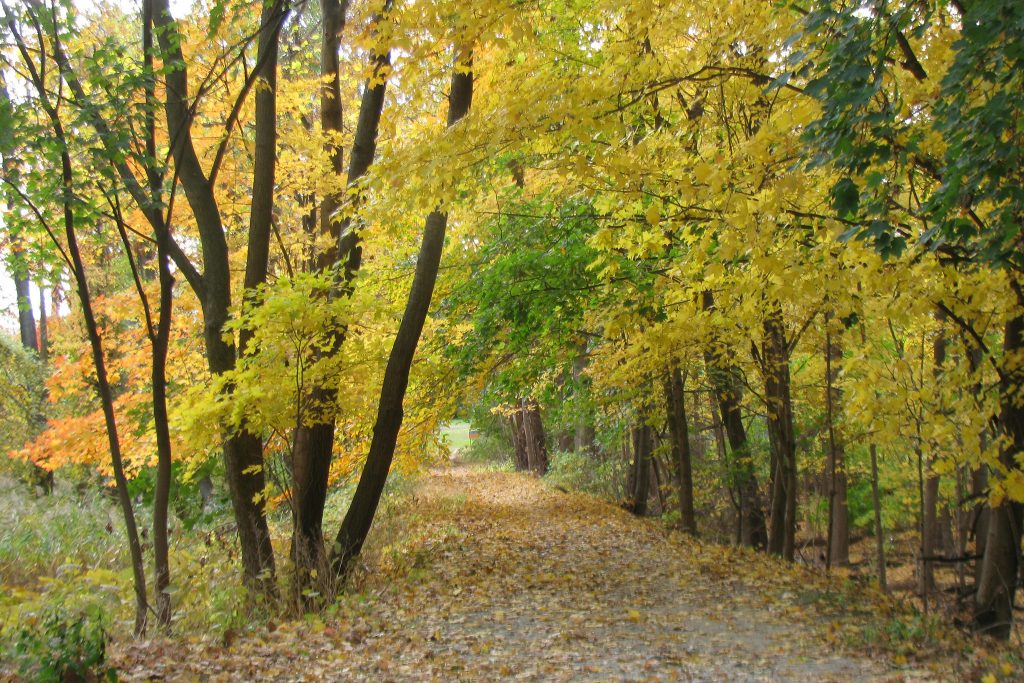
Everyone who knows New York City knows Central Park, the expansive, wooded green area that lies right in the middle of Manhattan. On sunny weekends it seems like the whole city is here, running, reading on the grass, or chatting with a friend on a park bench. While there’s no specific route here we recommend the most, we do love getting lost on the tree-lined trails for hours and people watching along the way.
Pro tip: Central Park is a nice place for a walk or a hike during any season, but we’d recommend heading there in the fall. Fiery colors light up the park for a truly magical scene.
Bronx River Greenway
- Location: The Bronx
- How to get there: Take the 5 train all the way to 241st Street, the trail begins near the train exit
- Distance: 8 miles
- Difficulty: Moderate
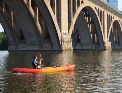
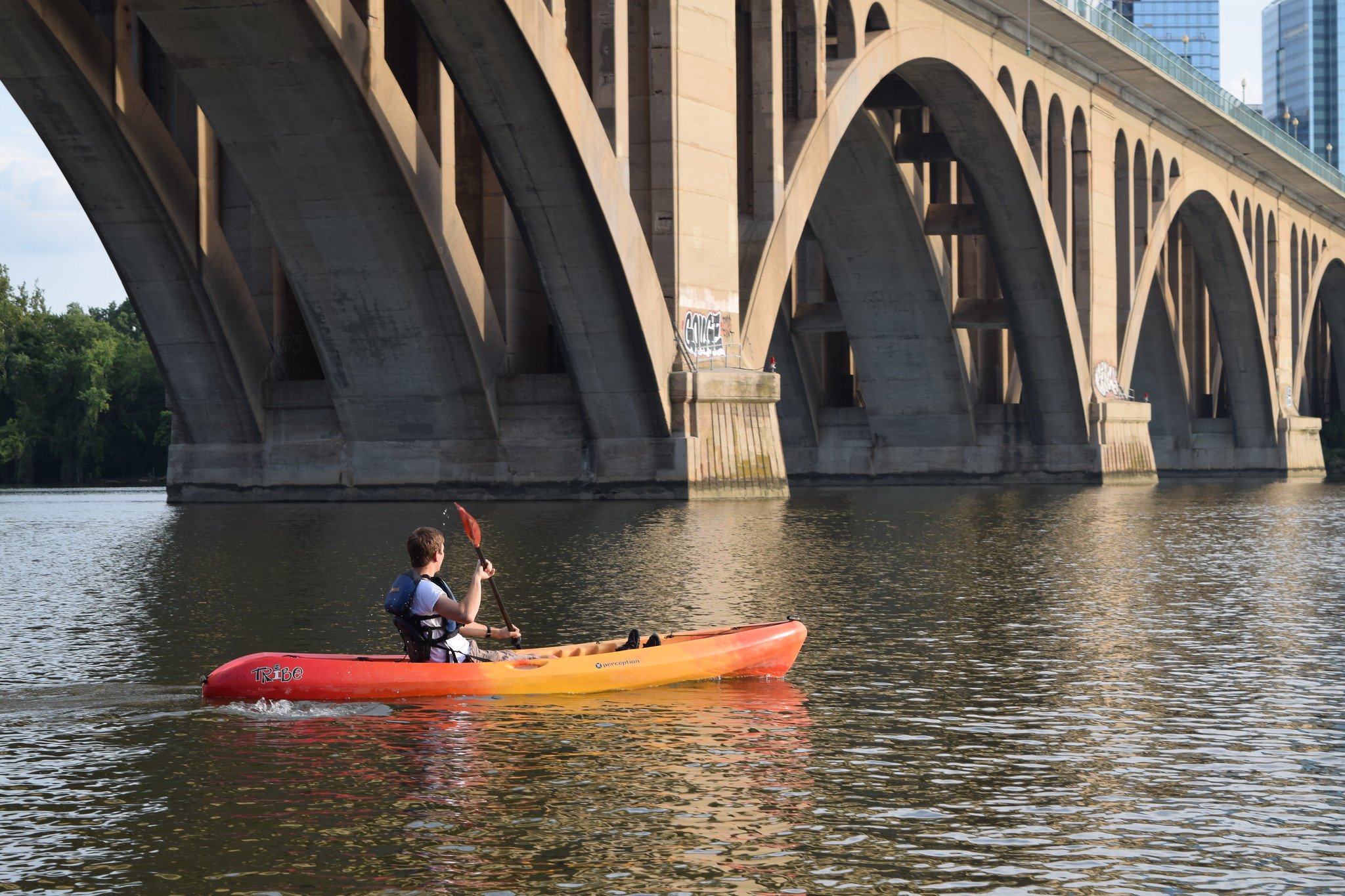
A hidden gem in the Bronx, the Bronx River Greenway is popular with local paddlers and anyone wanting to soak in the peaceful forest vibes this river trail has to offer. Extending 8 miles, the river here was recently restored and has cool, clean water to swim in. On summer days you can find nature lovers out here to play - splashing in the water or hiking through the meandering trails of the park. If you’re looking for true nature hideaways for hiking in NYC, you’ll certainly find one here.
Pro tip: Bring a swimsuit! You can easily pair your hiking adventure with a kayaking excursion down the Bronx River or a quick swim.
Brooklyn-Queens Greenway
- Location: Brooklyn & Queens
- How to get there: Take the 7 train, then get off at the Main Street-Flushing stop and find the trail head nearby
- Distance: Varies, total length is 40 miles
- Difficulty: Varies
If you’re looking for hikes in NYC that take you through diverse urban and nature areas, the Brooklyn-Queens Greenway might be a great choice for you. This massive trail system runs through two boroughs and spans wildlife areas, forests, marshes, residential streets, and city parks. For runners, the trail offers an excellent stretch of largely uninterrupted running that will keep your senses stimulated for miles and miles.
Pro Tip: Near Alley Pond Park, you can spot what some say is the oldest living organism in New York City - a tulip tree lovingly named the “Queens Giant”.
White Trail at Alley Pond Park
- Location: Queens
- How to Get There: Take the QM6 bus to Union Tpk/226th St, then walk ~15 minutes to Alley Pond Park
- Distance: 3.4 miles
- Difficulty: Easy
Speaking of Alley Pond Park, this beautiful park area is definitely worth a visit if you want to go hiking in NYC, even if you aren’t exploring the Brooklyn-Queens Greenway. Like we mentioned, you can find LOTS of trees here, including pine forests and the famous “Queens Giant” tulip tree. The White Trail is a family-friendly, easy hike that brings hikers of all levels away from the city streets and into what feels like pure, serene woods. The park sits on a moraine formed by a glacier and is home to many ecosystems across its forests, wetlands, and other terrain.
Gerritsen Creek Nature Trail
- Location: Brooklyn, near Jamaica Bay
- How to get there: The B3 bus goes directly to Marine Park, where you can find Gerritsen Creek Nature Trail
- Distance: 1 mile
- Difficulty: Easy
If you’re an avid bird watcher or wildlife lover, the easy, shoreside Gerritsen Creek Nature Trail is a fantastic spot to see all kinds of wetland wildlife, from herons to fish species. Located on the site of a former indigenous fishing settlement, Marine Park (where Gerritsen Creek is located) has undergone significant changes of the centuries, from industrialization to revitalization into a nature area. Nearby, you can also walk to numerous beach areas to enjoy the bay and the seaside vibes.
Blue Trail at Inwood Hill Park
- Location: Manhattan
- How to Get There: Take the A train to 207th St station
- Distance: 1.8 miles
- Difficulty: Easy
Inwood Hill Park is a beautiful spot in Manhattan for hiking in NYC. The Blue Trail is its longest trail, winding through the park for a modest 1.7 miles. In this short hike, you’ll have the chance to see caves, ancient rock formations, and glacial potholes. At the Overlook Meadow, you can catch stunning views of the Hudson River across to the New Jersey Palisades. From the trail, you may also have the chance to spot a majestic bald eagle - Inwood Hill Park is known as one of the best areas in NYC to see them.
The Yellow Trail at Staten Island Greenbelt
- Location: Staten Island
- How to get there: Take the Staten Island ferry, then from the terminal, take the S62 bus. Disembark at Bradley Avenue and transfer to the S57 bus, which will take you to Brielle & Rockland Ave. The entrance is nearby.
- Distance: 8 miles
- Difficulty: Moderate to difficult
We couldn’t leave off New York’s final borough, Staten Island, and its lovely Greenbelt Conservancy & Nature Center. This diverse green area has 6 trails, including four that are only for hikers (no bikes allowed!). The Yellow Trail is unique because it’s a bit more challenging compared to other hikes in NYC. Gems like Todt Hill and Moses Mountain, as well as bald eagle spotting, await hikers who make the trek out to this nature center.
Hudson River Greenway
- Location: Western Manhattan
- How to get there: Any train or bus heading west in Manhattan
- Distance: 12.9 miles total
- Difficulty: Easy
As one of Manhattan’s most popular walking, hiking, and biking trails, we absolutely could not leave off the Hudson River Greenway as one fabulous spot for hiking in NYC. While this isn’t a place to go for nature or wildlife, it’s fantastic for people-watching and for soaking in the cosmopolitan feels of Manhattan. Along the trail, you’ll get fantastic views of both the city and the river, and on sunny, warm days, you’ll be in good company, as it’s a beloved outdoor hotspot that’s centrally located.
Best Hikes Near NYC (That You Can Visit Without A Car)
Breakneck Ridge
- Location: Cold Spring, NY (~1 hour from NYC)
- How to get there: On weekends, take Metro-North from Grand Central Station all the way to Breakneck Ridge
- Distance: 4 miles
- Difficulty: Difficult
A local favorite for a more challenging, mountainous trail, Breakneck Ridge combines gorgeous scenery with accessibility to the city. At just one hour away from Grand Central Station, Breakneck Ridge is a fantastic spot for hiking near NYC that’s perfect for an adventurous day trip. The trail is about 4 miles of moderate to challenging terrain, including a few areas that require scrambling. Tough inclines are worth it, though - the views from the top of surrounding forests and mountainsides are absolutely jaw-dropping.
Read More: Everything You Need to Know to Hike the Breakneck Ridge Trail
Lake Skenonto Trail at Harriman State Park
- Location: Sloatsburg, NY
- How to get there: Take the NJ Transit train from Penn Station to Tuxedo Station, then walk 0.5 miles to the trail head
- Distance: 8.1 miles
- Difficulty: Moderate
If you’re looking for a true escape from New York City, the Lake Skenonto Trail at Harriman State Park winds through forested areas and rolling hills to a serene lake. Here, you can expect a moderate level of hiking, namely a few steep uphills to hike through the mountains before arriving at the lake. The trail is largely forested, but opens up to blue skies as you approach the lake. At just one hour from the city, the Lake Skenonto Trail is one of the most easily accessible nature hikes near NYC on our list.
Pro tip: If you’re visiting in the heat of summer, be sure to pack a swimsuit and towel and enjoy the cool, fresh waters of the lake as a reward!
Old Croton Aqueduct Trail
- Location: Dobbs Ferry, NY
- How to get there: Take Metro-North from Grand Central Station to Ossining; you can begin your hike on the trail 0.5 miles from the station (click here for detailed directions)
- Distance: 26 miles total (can be shortened)
- Difficulty: Easy
For history lovers, the Old Croton Aqueduct Trail is one of the best hikes near NYC, where you can walk through the former area that ran fresh water from upstate into New York City.
Aside from being in the aqueduct itself, the trail also features some really interesting sites dating back 175 years or more, like the New Croton Dam, historic homes, and the real life Sleepy Hollow village (yes, the one with the Headless Horseman…). As an easy trail that’s suitable for hikers of all levels, Old Croton Aqueduct is a wonderful place to trade the city for tree-lined trails.
Arden Point and Glenclyffe
- Location: Cold Spring, NY
- How to get there: Take the Metro-North Hudson train to Garrison, then find the signs at the station for “Arden Point - Hudson Highlands State Park”
- Distance: 3.8 miles
- Difficulty: Easy
Easy, beautiful, and accessible - what makes for a better hike than that? Arden Point and Glenclyffe is a strikingly beautiful trail through pathways used during the Revolutionary War. Aside from the history, there are tons of scenic lookouts and breathtaking views from this loop trail, including views of the Hudson River, West Point, and some pretty lavish upstate homes.
Once you head towards the trail from the train, you’ll cross a steel bridge before starting towards Arden Point. Along the loop trail, you’ll find ruins of old buildings and serene forest areas dotted with lots of pretty views.
Storm King State Park & Art Center
- Location: New Windsor, NY
- How to get there: Take the Metro-North Hudson line from Grand Central Station to Beacon Station, then a shuttle to Storm King. There’s also a discounted pass sold at Grand Central called the Metro-North Getaway Package.
- Distance: Varies
- Difficulty: Easy
One of the most unique places for hiking near NYC is Storm King State Park - kind of like a state park meets an art exhibit. The park a naturally beautiful and scenic area with rolling hills and large meadows, and there are several trails all over the area that lead to various, massive art structures. Art lovers will enjoy this cross-section of nature trails, permanent art fixtures, and shifting exhibitions, and nature lovers will enjoy the many twists and turns the trail takes through the park area.
Stairway to Heaven (Appalachian Trail)
- Location: Vernon, NJ
- How to get there: Catch the NJ Transit bus #196 or #197 to Warwick. From there, it’s a 10-minute Uber or taxi to the trail
- Distance: 2.6 miles
- Difficulty: Moderate
For hikers who enjoy a challenge, as well as lots of surprises along the trail, Stairway to Heaven is one of the best spots for hiking near NYC. Located in New Jersey, the trail takes you to the top of Mount Wawayanda, twisting through rocky areas and forests to the summit, which boasts stunning views of the surrounding hills. Along the 2.9 mile trail, there are tons of beautiful rock formations as well as a picturesque suspension bridge.
Pro tip: With large, varied rock formations, climbers should come with gear to take advantage of the bouldering and scrambling opportunities.
Read More: A Complete Guide to Hiking the Stairway to Heaven Trail in New Jersey
Fire Island National Seashore
- Location: Long Island, NY
- How to get there: Take the Montauk Branch of the LIRR from Penn Station to Bay Shore, Sayville, or Patchogue to access ferry terminals. From there, you can find a list of ferry options to various parts of the seashore here.
- Distance: Varies
- Difficulty: Varies, mostly easy
Located on Long Island’s coast, Fire Island National Seashore is a different kind of hiking experience than the one on our list. For starters, much of the park area is only accessible by ferry, meaning you’ll need to set aside a full day for Fire Island. Second, since it’s so remote, you’ll be able to find fairly private seaside trails year-round, unlike some of the more popular spots on our list. The park boasts a beautiful historic lighthouse as well as sandy shorelines where you can explore. Just make sure to stay off the dunes - they’re protected areas on the island for many reasons.
Anthony’s Nose Trail (Appalachian Trail)
- Location: Hudson Highlands, NY
- How to get there: Take the Metro-North Hudson line and get off at the Manitou stop, then walk 1.5 miles to the trail head
- Distance: 2.6 miles (5.6 including walk from the train)
- Difficulty: Moderate
If you’re wanting to explore even more sections of the Appalachian Trail, Anthony’s Nose is a great place for hiking near New York City. Connected to the nearby Camp Smith Trail, this hike can lengthen depending on how far you’d like to go. It’s one of the quintessential Hudson Valley hikes and one we’d recommend for hikers of all levels!
Accessible by Metro-North, the short stretch of the Appalachian Trail at Anthony’s Nose features a 500-foot rock staircase - a real workout - followed by stunning views along the mountain ridge. From the top, you can see the Hudson River, the Bear Mountain Bridge, and the surrounding mountains.
Bellvale Mountain (Appalachian Trail)
- Location: Warwick, NY
- How to get there: Catch the NJ Transit bus #197 to Route 17A and Kain Road, then walk to Continental Road to begin the hike
- Distance: 7.7 miles (one way)
- Difficulty: Difficult/Expert
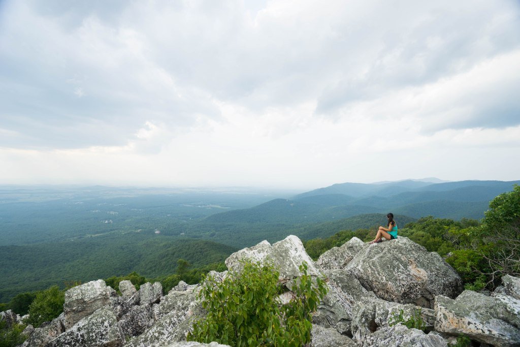
For hikers wanting a bit more challenge than the other trails on this list, the Bellvale Mountain trail on the Appalachian Trail is a challenging ridge hike that requires some experience under your belt. Not for the faint of heart, those who do tackle the Bellvale Mountain trail will be rewarded with incredible views from the Prospect Rock viewpoint, which is the highest post of the Appalachian Trail in the state of New York. From the top, you’ll see breathtaking vistas of nearby Greenwood Lake, Sterling Forest, and the surrounding areas.
Additional Resources on Hiking Near NYC
- 17 Awesome Hudson Valley Hikes for Your Next Adventure
- 15 Beautiful Places to Go Canoeing and Kayaking in NYC
- 17 Awesome Places to Go Skiing near NYC
- 50+ Amazing Outdoor Quotes to Inspire Your Next Adventure
- 15 Jaw-Dropping Hikes In and Near Washington, DC for All Levels
Did you enjoy this post? Don’t forget to pin it for later!


